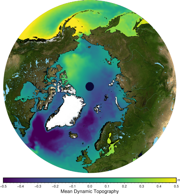
A new Mean Dynamic Topography released
Image of the Month - March 2022
When using altimetry, we are working most of the time with height variations (aka sea level or sea surface height anomalies) or with heights with respect to a reference ellipsoid. The mean currents are in the mean sea surface which can be computed by using years of altimetry data with respect to the ellipsoid, but this surface also includes the geoid. And, for a long time, the geoid was not well known. Now, with dedicated gravimetry missions, it is better defined. Moreover, another approach can be used: measuring the surface currents using drifting buoys, to compute their mean flow. Or the two approaches can be combined, removing the geoid from the altimetry mean sea surface as a first step, then refining the result using the in situ data for finer details. Close to the North American Atlantic coasts (Mid Atlantic Bight), adding high frequency radar measurements have been tested.
Twenty years have gone since the first Mean Dynamic Topography dataset disseminated through Aviso. The new CNES-CLS22 MDT is now available for use.
See also:
- Applications: Large-scale ocean circulation
- Image of the Month, February 2003: Ocean currents
- Data / Auxiliary: MDT - MDT-CNES-CLS22 or MDT-HYBRID-CNES-CLS22-CMEMS2020 (with Mediterranean and Black Seas)
Reference:
- Jousset S., S. Mulet , J. Wilkin, E. Greiner, G. Dibarboure, N. Picot, 2022, New global Mean Dynamic Topography CNES-CLS-22 combining drifters, hydrological profiles and High Frequency radar data, OSTST 2022, Venice, https://doi.org/10.24400/527896/a03-2022.3292


