The ocean is going up and down around the Solomon Islands
Image of the Month - November 2007
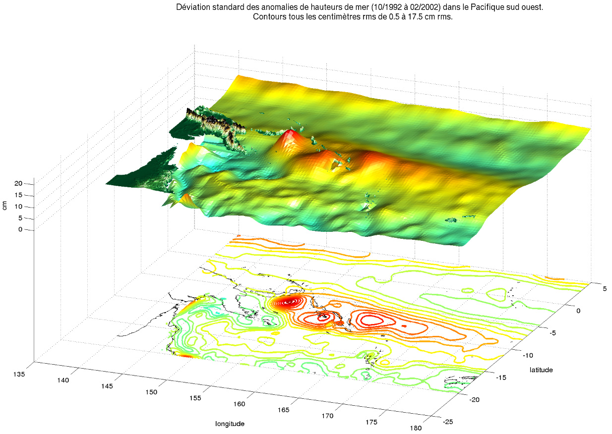
Regions of highest dynamic topography variability are in general regions of highest turbulence, like the western boundary currents of all the oceans (Gulf Stream, Kuroshio...). Some few regions also vary a lot, without our precise understanding of the physical origin of such high variability.
This is the case in the Solomon Sea, where variability of more than 15 cm RMS is observed around the Solomon Islands over a large area (about 1000 km).
A specific reprocessing of altimetry data was done; high resolution digital simulations are made to reproduce such processes in models, and thus better understand the causes of this variability. It could be due to El Niño Southern Oscillation (ENSO), to the Madden-Julian oscillation (atmospheric oscillation at the Equator), or to South Equatorial counter-current instabilities... The role of bathymetry is also examined; conclusions are still open.
See also:
- Applications: RMS of Sea Level Variability
References:
- A. Melet, L. Gourdeau, W.S. Kessler et J. Verron, 2007: Variability in the Solomon Sea from altimetric sea level. AGU San Francisco

