Jason-2: first year in orbit
Image of the Month - July 2009
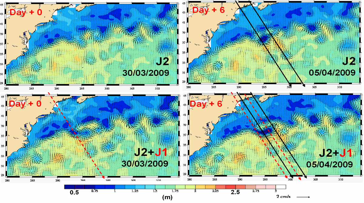
Absolute dynamic topography in the Gulf Stream region, seen by one satellite only (Jason-2, top) and by the Jason-2-Jason-1 tandem (bottom) at a six-day interval. Eddies are better observed, and transition much smoother with both the satellites together (eddies are not "poping up" from nowhere: see Jason-2 animation vs tandem animation (10MB each)) (Credits CLS/Cnes)
Jason-2 was launched on June 20, 2008. Now, a little more than one year later, fully operational, the satellite is fulfilling all the expectations that were put in him -- and more. Even more precise than Jason-1, with much more data near the coast and on inland waters (thanks to new tracking modes), Jason-2 is providing a seamless transition with Jason-1 on mean sea level trends.
Four months ago, Jason-1 has been shifted on a new orbit, thus forming a new tandem mission, with a enhanced coverage. Such flight configuration is providing better resolution of eddies and meanders, especially since the satellites are intercalibrated, and of the same design.
See also:
- Image of the Month, May 2003: Flying tandem
- Data: Ssalto/Duacs near-real and delayed time multimission altimeter products
References
- I. Pujol et al., Three-satellite quality level restored in NRT, poster (pdf, 3.7 MB), OSTST meeting, Seattle, 2009
- J. Willis, Jason1 Tandem Mission: Early results, keynote talk, OSTST meeting, Seattle, 2009

