Sorting ice from space
Image of the Month - June 2008
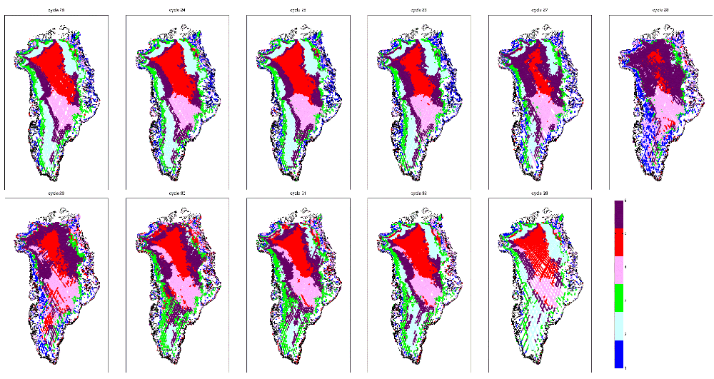
Satellite altimetry is a major tool to better understand ice sheet behaviour. In particular Envisat dual-frequency altimeter and radiometer provide measurements up to 82° of latitude, and so covers a large part of the Earth's iced surfaces.
The frequencies used by the altimeter and radiometer penetrate differently within the snow (see e.g. Image of the Month, October 2006: Altimeter looks into the crevasses). Moreover, the measurements taken depend on the snow characteristics. It is thus possible to separate regions of distinct snow morphology.
The different categories of snow thus defined are in good agreement with previous studies based on in situ or scatterometer data. They defined categories (facies) such as dry snow, percolation (when surface ice melt and percolates through the snow, refreezing eventually), wet snow (with free water), and bare ice (i.e. winter snow have melt, leaving the underlying ice exposed). Such partition of Greenland using spaceborn sensors enables finer monitoring of areas highly sensitive to climate variations.
See also:
- Applications: Ice
Reference:
- Tran, N, F. Rémy, P. Féménias, Snow facies over ice sheet derived from Envisat active and passive observations, IEEE Trans. Geosci. Remote Sens., Vol. 46, No 11, 3694 - 3708, November 2008, doi 10.1109/TGRS.2008.2000818.

