Better Mediterranean circulation
Image of the Month - October 2014
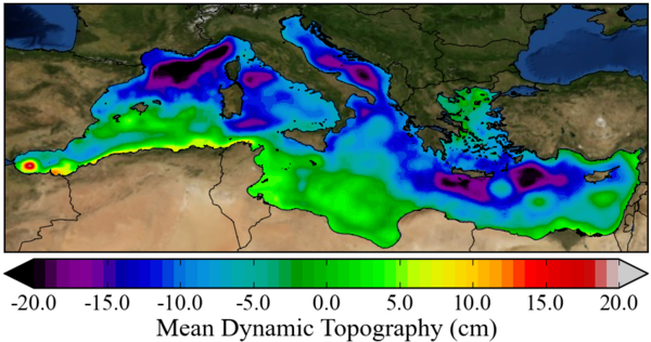


The Mediterranean Sea is characterized by narrow straits, numerous islands and a very convoluted coastline. Mediterranean sea circulation is thus complicated, and its study needs a higher-resolution dataset than in most areas of the ocean.
The avaibility of more in situ drifter data and the longer and longer altimetry data time series enable to improve the mean ocean topography over the Mediterranean area, and thus the mean (geostrophic) circulation.
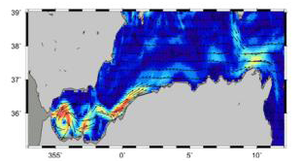
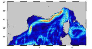
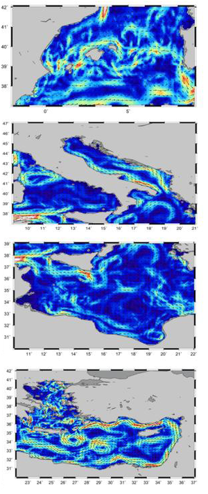
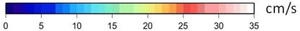
On the new Mediterranean Mean Dynamic Topography thus computed, the Alboran gyres, Ierapetra or Bonifacio gyre are visible. The Liguro-provençal current shows as a low areas on the topography map (or a strong thread of current on the current map).
Altimetry enable to better know the ocean circulation. With long period of time available, and several satellites ongoing at the same time, the knowledge of this circulation is improving, even in complex areas like the Mediterranean.
See also:
- Applications: Mediterranean Sea
- Applications: Large-scale ocean circulation
- image of the Month, September 2006: Mediterranean currents
Websites on this subject:
References:
- M.-H. Rio, A. Pascual, P.-M. Poulain, M. Menna, B. Barceló, and J. Tintoré. Computation of a new mean dynamic topography for the Mediterranean Sea from model outputs, altimeter measurements and oceanographic in situ data. Ocean Sci. , 10, 731-744, 2014. http://www.ocean-sci.net/10/731/2014/os-10-731-2014.html doi:10.5194/os-10-731-2014.

