El Niño's return, West side story
Image of the Month - July 2015
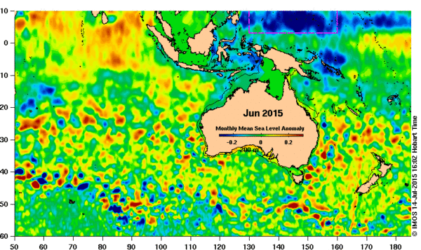
El Niño's name comes from South America. However, this phenomenon impacts the whole Pacific, the Western part no less than the Eastern, though in opposite ways. While on the Peruvian coasts El Niño means heavy rainfalls, higher-than-usual sea levels and temperatures, along the Australian, Papuan and Indonesian coasts it means drought and lower sea levels and temperatures. This being as much a problem as the reverse. In 1997 in particular, a lot of forest fires devastated Indonesia.
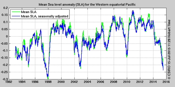
Currently an El Niño is developing. Most forecasts predict that it will stay till the beginning of 2016 with a moderate to strong intensity. The situation on the Western side of Pacific is close to what it was in 1997.
Altimetry enables to monitoring such events and helps in their forecasts. It is also an important asset to be able to better understand them, and thus better forecast them, including their intensity. With the continuity of altimetry since 1992, an unprecedented time series has been collected. Next satellites will help continues on.
See also:
- Data/Ocean indicators: El Niño bulletin
- Applications: El Niño
- Diagram and map plotting: Live Access Server
Websites on this subject:
- IMOS and IMOS news on 2015 El Niño
- Australian Bureau of Meteorology ENSO tracker
- Climate.gov (Noaa) ENSO blog

