High-resolution coastal observations
Coastal areas are complex zones, with large variations in water levels and major economical and ecological issues. However, classical altimetry can only get at the very least (Saral) to 5-10 km from the coasts. With Swot, a real continuity "from the open ocean to the beach" is possible and this in 250-m resolution. Even higher resolution is provided by the land-processed data 3 km from the coasts.
Estuaries
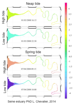
Estuaries serve as a meeting point between land and sea. Estuarine hydrodynamics are very complex because there are interactions between different water bodies: the sea with the same phenomena as the coast ocean (tides, waves, surges, sea level rise) but also the river, its tributaries, and groundwater. Numerical models have been increasingly used to predict river and estuarine flow, water quality and sediment and contaminant transport processes. However, to better define these models, and also to assimilate data into those models, one needs data, but only a few estuaries in the world have enough in situ gauges to allow this. The interest of using satellite height data for estuaries is to provide information on the hydrodynamic spatial variability. Until now, within estuaries, the contribution of satellites has mainly focused on the monitoring of water color and its relation to suspended sediment and chlorophyll. However, e.g. turbidity distribution varies considerably with tidal and river flow conditions, fluctuating on a variety of timescales, and are heavily influenced by bottom topography. In order to validate these models, we need the high resolution, 2D satellite altimetry data which Swot is bringing.
NearShores


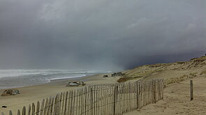
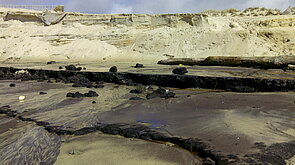
The nearshore regions are subject to large variability at different time and spatial scales due to interactions between tides, waves, storms and currents. These physical processes, responsible for the coastal morphological evolution, should be examined in detail for coastal prevention from flooding and shoreline retreat.
In situ data are sparse here. In the case of French coasts, the national network of tidal gauges has 63 tidal gauges for 3427 km of coastline. Moreover, tide gauges are located in sheltered areas (such as harbours). To overcome the lack of measurements, the use of nearshore models is important in this case, but they are difficult to validate. Thus there is a pressing need for sea level observations with short space and time scales, required to validate and calibrate these numerical models. The limited coastal gauges can be coupled to satellite altimeter measurements to improve the coverage in these environments.
The assimilation of offshore classical altimetry data, as frequently used in models nowadays, is problematic since it leaves an unconstrained nearshore band of 10-25 km, and the principal errors on the shelf may lie in the wind forced currents. Models with assimilation that combine all available data are being developed, but the absence of spatially coherent sea level observations in the nearshore zone remains a problem. Input parameters to supply the morphological models which should be coupled to the hydrodynamic ones in order to determine the evolution of the coastal features are also needed.
The 2D high resolution Swot measurements provide these much-needed SSH data with regular snapshots at very high-resolution right up to the shore. Moreover, the Swot orbit has been chosen to observe the principal 8 tidal constituents, and to help observe the more complex non-linear tidal constituents in the coastal zones. The global Swot coverage allows nearshore studies in many key sectors of economic and/or ecological interest and/or potential hazards of flooding, sea level rise and shoreline retreat.
Shelf processes
The contiental shelf is the coastal region lying within several tens to hundreds of kilometers from shore. The societal importance of the shelf regions is derived from their many uses: navigation, fisheries, mineral extraction, recreational use... These activities make world's shelf regions major focal points for operational oceanography, requiring not only observation, but prediction.
In these regions, bathymetric gradients as well as the shoreline directly influence the ocean circulation, hydrology and biogeochemistry. Exchanges between the deep ocean, the shelves, near-shore regions and estuaries also occur. The dynamics over the shelf can become complicated, and the interacting processes and features can create energetic and rapidly changing circulation structures, with strong vertical velocities.
The primary attribute of Swot data is the ability to produce high-resolution, nearly instantaneous "snapshots" of sea surface height (SSH), the primary variable, along with information about winds and waves with similar resolution. The basic spatial resolution over most of the shelf is the same as in the open ocean, 250 m gridded data points with uncertainties of several cm. The advent of Swot sampling represents a major innovation and addition to the sources of information needed for nowcasts and forecasts of ocean conditions for this wide assortment of activities.
This high-resolution "snapshots" allow a better characterization of the spatial structure of the ocean circulation, including the strongly anisotropic (non-circular) structures close to coasts or bathymetric canyons, which create strong currents across the fronts, squirts and jets that form in the coastal ocean. The challenge lies in the combination of this high spatial resolution with lower temporal resolution. At mid-latitudes there are several observations during each 21-day exact repeat period, producing observations every 5-10 days (more often at higher latitudes). Thus, it is not possible to observe the temporal development of the small-scale features that are seen in the instantaneous SSH fields. Several ways to overcome this issues are possible, via a combination with tide gauges and other in-situ or satellite data, and assimilation into coastal models.


