Classic version
Toggle navigation
DATA
Products guide
Products
Data access
Product information
CALVAL
TOOLS & SERVICES
Software
Visualization Tool
Pass locator
Calendar days or julian days
Science teams
APPLICATIONS
Ocean
Coastal ocean applications
Ice and Cryosphere
Climate
Atmosphere, wind and waves
Geodesy and geophysics
Biology
Navigation by area
MISSIONS
Timeline Altimetry
Past missions
Current missions
Future missions
TECHNIQUES
Altimetry
Radiometry
NEWS
Archives
Aviso Newsletter
Search
Front-page news
Image of the month
Operational news and status
RESOURCES
Outreach material
Education
Classic version
Missions
Missions
[
display
]
Timeline Altimetry
.
Past missions
.
Current missions
.
Future missions
.
Timeline Altimetry
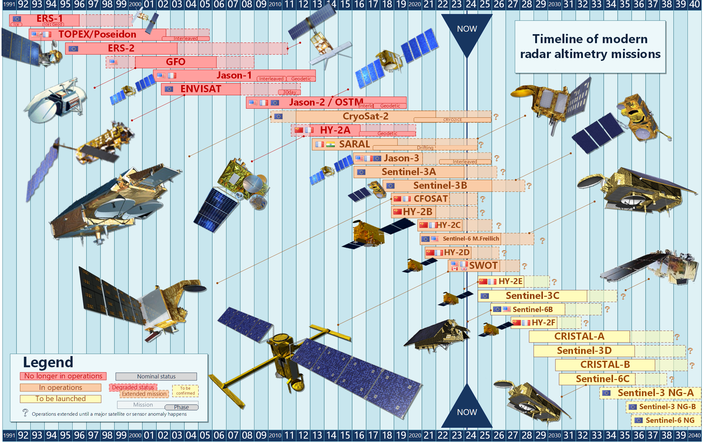
A figure showing the timeline of radar altimetry missions is available
here
.
Past missions
Geosat
ERS-1
Topex/Poseidon
ERS-2
GFO
Jason-1
Envisat
Jason-2
HY-2A
Spot
Current missions
Cryosat
Saral
Jason-3
Sentinel-3A
Sentinel-3B
CFOSAT
HY-2B
HY-2C
HY-2D
Sentinel-6MF
Swot
Sentinel-6B
Future missions
Sentinel-3C
Sentinel-3D
Cristal-A
See also
future technology improvements
Contact
Partners
Lexicon