Flood in the Zambezi basin
Image of the Month - May 2009
 |  |  |
 |  | |
 | 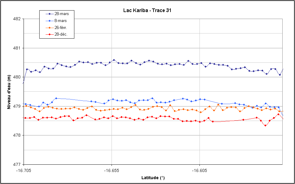 |
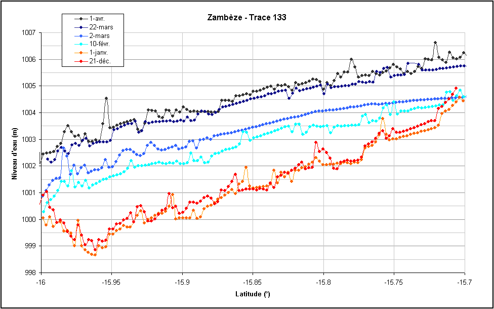
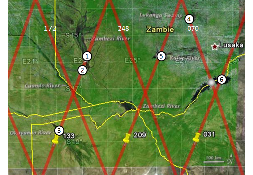
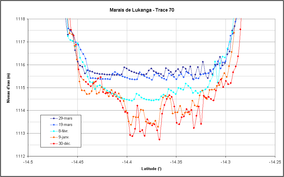
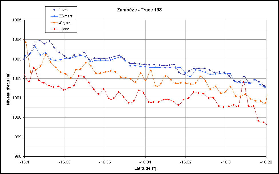
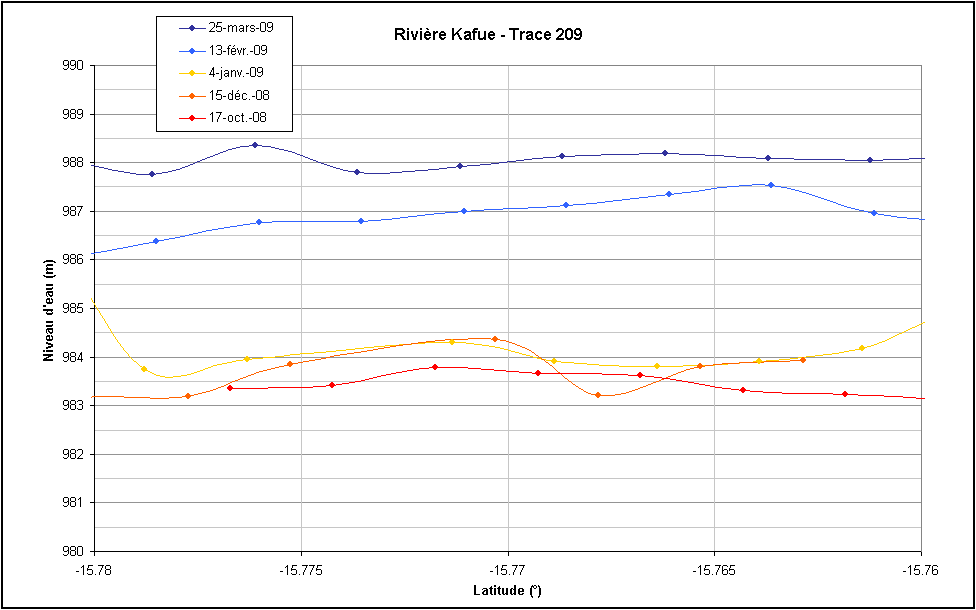
Rise of the water level on several locations of the Zambezi river basins (river, lake, swamp, delta) from late 2008 to early April 2009, as measured by Jason-2 altimeter (data provided by an hydrology specific processing). Time series are presented from top to bottom and left to right (Credit CLS/Cnes).
In March 2009, the upper Zambezi river and its tributaries (South-East of Africa) had seen the worst flooding for fifty years. The waters of the Okavango delta in Botswana have reached their highest levels since 1939. Flooding in the upper Zambezi river basin has displaced hundreds of thousands in Angola, Namibia and Zambia.
Monitoring of river and lake level was not planned at first as an application of altimetry. However, the altimeter capability to monitor such levels, and the high interest in such applications, have quickly been demonstrated. An ongoing Cnes project to process altimetry data for coastal and hydrology applications ("Pistach" project) provides data over the region, giving access to the surface elevation beneath the Jason-2 tracks every 10 days.
The Swot mission project (Nasa/Cnes) has specifically such goals in mind. It should measure the rivers and lakes levels using a wide swath altimeter.
See also:
- Applications: Hydrology and land
Websites on this subject:
- Hydroweb (Legos/CNRS)
- Swot, a satellite for hydrology.
References:
-
Mercier, F., N. Picot, P. Thibaut, A. Cazenave, F. Seyler, P. Kosuth, E. Bronner, Cnes/Pistach project: an innovative approach to get better measurements over inland water bodies from satellite altimetry. Early results, EGU General assembly, 2009.

