Altimetry in Mesopotamia

Tigris and Euphrates are rivers of a capital importance for people living in the region, from the Sumerian six millenium and more ago, to modern-day Iraqis. If water management has always be vital -- up to the point of being in part at the origin of civilization and writing in the area--, it reaches now a critical point. Numerous reservoirs have been built upstream, in the four countries where these rivers flow (Turkey, Syria, Irak, and Iran), modifying substantially the hydology of the whole basin. Moreover, the marshes in the delta of the two rivers have been dryed up for the most part, then re-flooded for some, which lead to in-depth modification of the environment. Satellite observation of this hydrology is thus of special interest, especially since in situ measurements are scarce and difficult to retrieve.
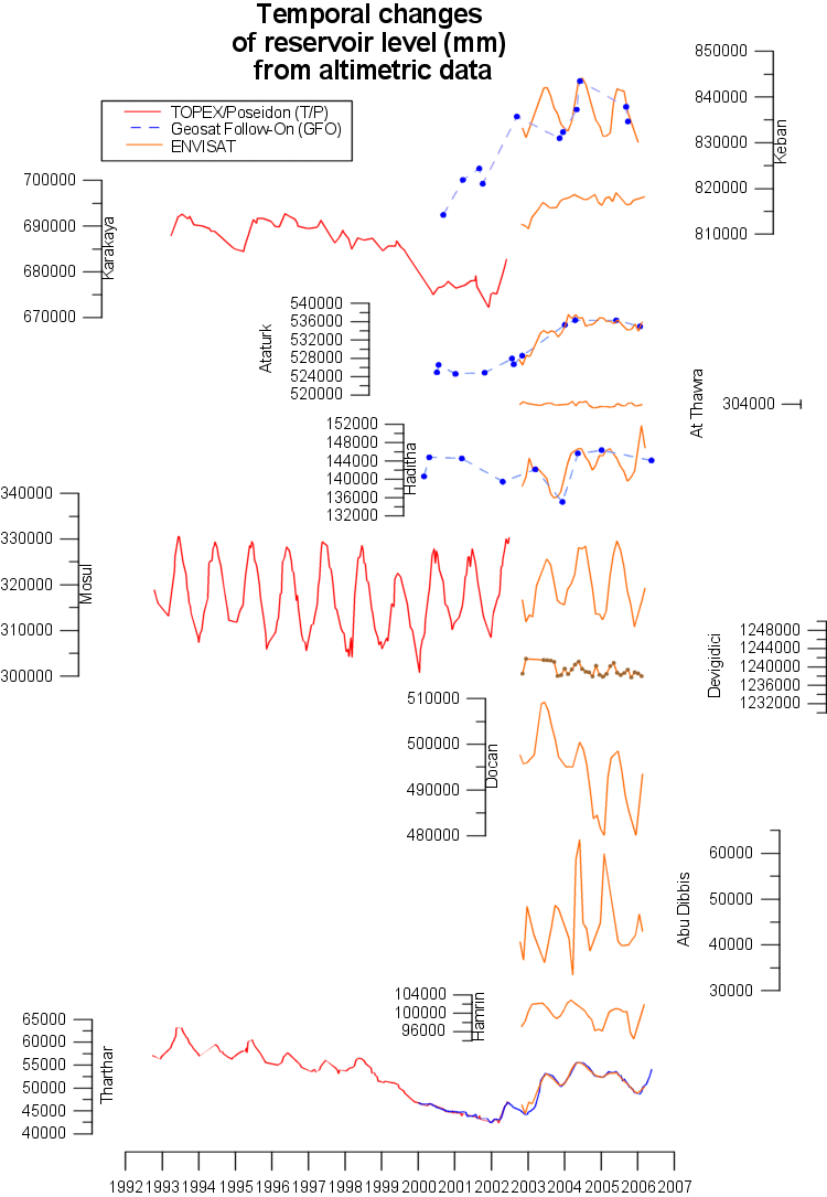
Time series of water level (meters with respect to geoid) as measured by altimeters for Mosul and Karakaya reservoirs, and for Tharthar lake (in red on the map). Seasonal variations of more than 25 m are observed on Mosul reservoir on the Tigris. Karakaya reservoir, and Tharthar lake both decreased between 1997 and 2001.
(Credits Legos/State Oceanography Institute, Russia)

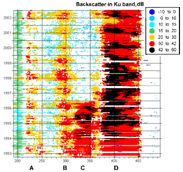
Backscatter coefficient along Topex/Poseidon ground track #31 (see map). In the "C" area, this coefficient changed drastically in 1996: the marshes were dried up; thus the radar does not reflect anymore on water, but on land, which leads to a weaker altimeter echos measured by the satellite.
(Credits Legos/State Oceanography Institute, Russia)
References:
- E.A. Zakharova, A.V. Kouraev, J.-F. Crétaux, F. Al-Yamani, I. Polikarpov, Radar Altimetry for Studies of Large River Basins: Hydrological Regime of the Euphrates-Tigris Rivers, Envisat Symposium, Montreux, Switzerland, April 2007

