Four seasons in the Atlantic
Lively Data : August 11, 2003
One of the reasons for sea height variations is the heating of water in Summer by the Sun (and its cooling in winter, see Applications: Ocean Seasons). With the Live Access Server, you can choose between every available dates to draw maps (since August 22, 2001 for Ssalto/Duacs merged sea level anomalies). Thus we can see sea surface height increasing or decreasing along with air temperature (with a lag, due to the delay needed for this heat transfert).

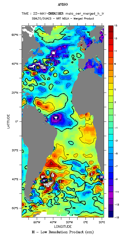
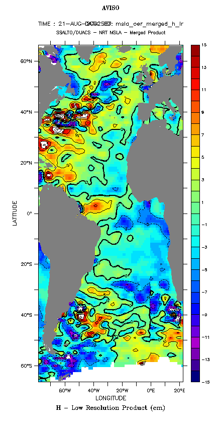


"Low resolution" merged sea level anomaly maps over the Atlantic Ocean, on February 20, May 22, August 21 and November 20, 2002. On the first two maps, the South Atlantic is warmer than North Atlantic (February is during South Hemisphere summer), and vice-versa on the latter two. (Click on the map to enlarge them).
 Use the Live Access Server

