Question of resolution
Lively Data : July 15, 2003
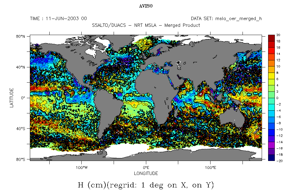
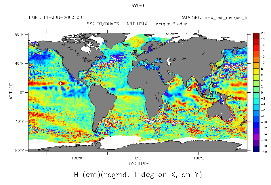
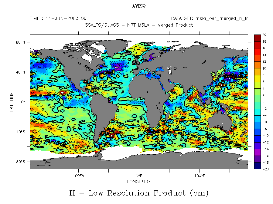
Ssalto/Duacs sea level anomaly data are available in two versions with different resolution. High-resolution data (1/3°x1/3° on a Mercator grid) shows the eddies and other ocean circulation variability features of "medium" size (i.e. some tens of kilometers). Low resolution version (1°x1°) shows major features of ocean variability, among which are those with an impact on climate, like El Niño and La Niña (see Applications :El Niño - Southern Oscillation and Data - Duacs: High / low resolution maps). When visualizing global maps, it is often best to use those low resolution data, using high resolution ones to view smaller areas.
Multi-satellite ("merged") sea level anomaly maps. Top, high resolution version (Maps of Sea Level Anomalies), with contours and color scale fit to fill : (-20,20,2). Middle, the same without contours, more legible (plotted by giving values to the contours outside the extreme values of the data, e.g. (1000,1100,2)). Bottom, the low resolution version (variable "MSLA Low resolution"), also for merged data, shows the major features of ocean variability.
(Click on the map to enlarge them).
 Use the Live Access Server

