Scaling the ocean
Lively Data : July 7, 2003
One of the question when you want to visualize data - whether altimetric ones, or other - is from which value up to which one they vary.
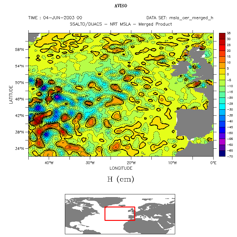
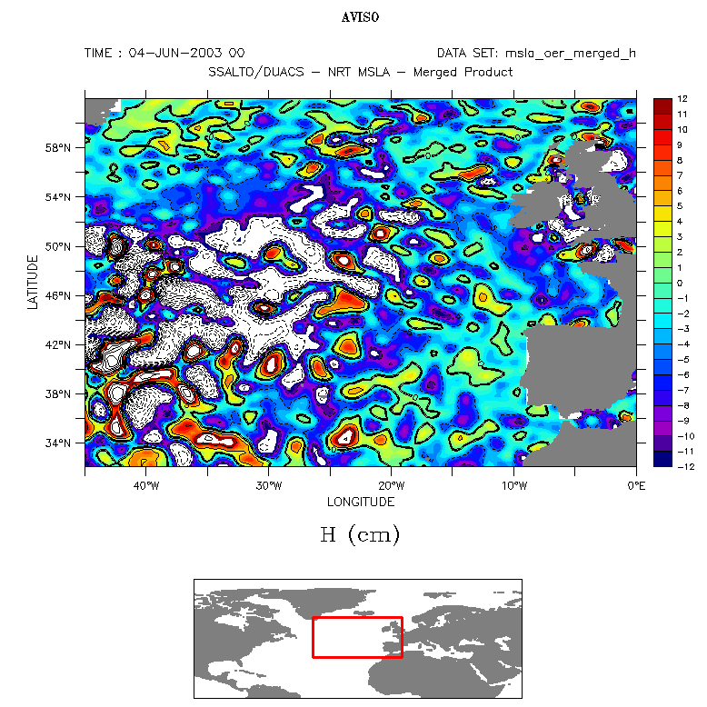
The LAS compute its color scale automatically, taking minimum and maximum values of the dataset on the region you want to visualize. But Sea level anomalies have often extreme, localized, values. Automatic scale adapts to them, and thus muffle some low-intensity phenomena. It is often better to define yourself the color scale extrema, by clicking on "output options", then typing in "fill option" : (min, max, interval).
If a very turbulent zone, like the Gulf Stream (see Applications: Variability of ocean circulation) is in the region of interest, extreme values will be very high, and small sea level anomalies will not appear on the map (e.g. here in the Gulf of Biscay); Top, automatic scale, bottom -12 cm to +12 cm scale: higher-values are blank zones, but smaller phnomean are visible
(Click on the map to enlarge them).
 Use the Live Access Server

