South of Africa, currents and sea level heights
Lively Data : June 30, 2003
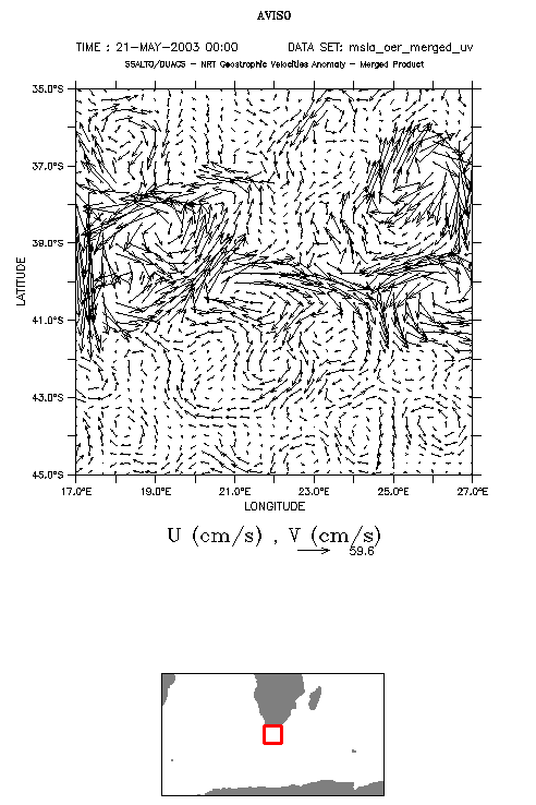
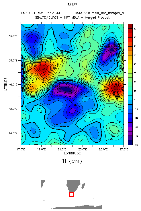
South of Africa (here between 35 and 45°S, 17 and 27°E), ocean is an area where currents converge, very turbulent (see Applications: Agulhas rings).
The LAS draw the geostrophic currents maps over a 10°x10° area (larger than that, averages made by the LAS are not significant, especially over such a turbulent zone with currents changing drastically from point to point). This ocean circulation can also be viewed -- always with the LAS -- from sea level anomalies; on such a map, two pairs of "hills and valleys" are clearly shown, that correspond to eddies that circulate in clockwise and counter-clockwise directions. Current speeds are proportional to the slopes of the "hills" or "valleys".
(Click on the map to enlarge them).
 Use the LAS

