What's behind "MADTs"
Lively Data : December 15, 2005
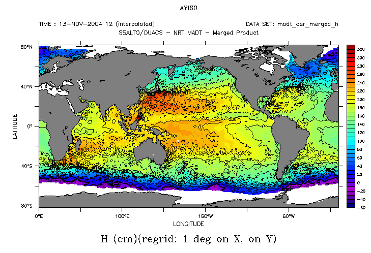
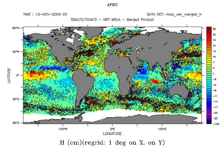
One year ago, we began publishing, the a new dataset the "MADTs" (Maps of Absolute Dynamic Topography). Those maps seems very different from our usual SLAs (Sea Level Anomalies), but in fact they differ only by a constant. This constant is the Mean Dynamic Topography, a dataset computed from altimetry, gravimetry and in situ measurements. Adding it allow to take into account the stationnary currents, i.e. the sea surface height due to the great currents like the Gulf Stream or the Kuroshio, which can be as high as more than a meter that sea surface height outside them.
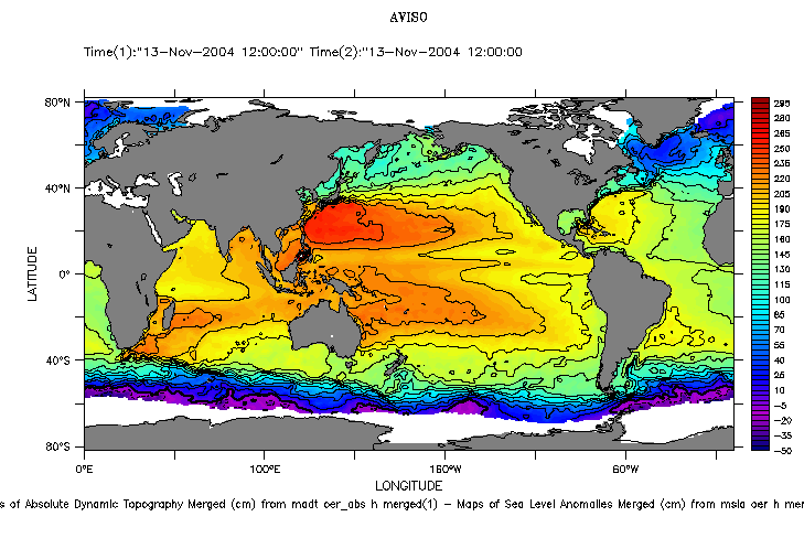
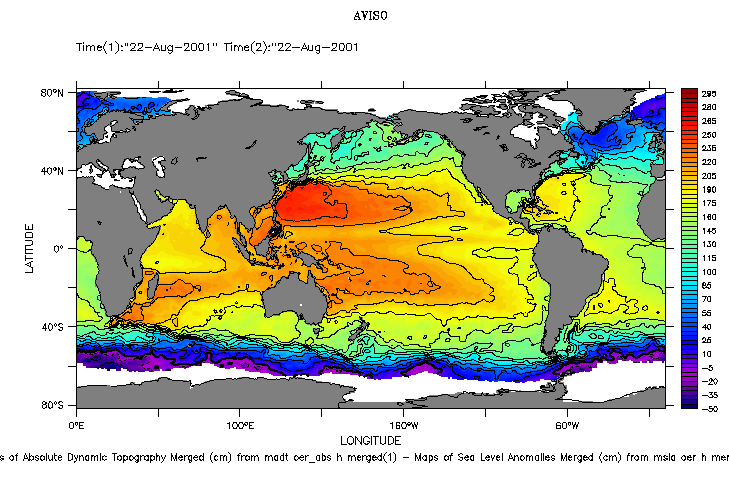
MADT et MSLA on November 13, 2004, and their difference, computed with the LAS, by using the "compare two feature, selecting the two above-mentionned datasets, and then the "comparison plot" output. You thus have the "MDT" (Mean Dynamic Topography), time-independant map -- if you try the same plot on another day, say August 22, 2001, you get exactly the same map.
 Use the Live Access Server

