Currents on the slope
Lively Data : November 17, 2004
Absolute dynamic topography takes into account sea surface height due to mean currents, plus the ocean circulation variations (or sea surface anomalies). Associated geostrophic current velocities, computed from the topography slope, show the current stream, with its meanders. The Kuroshio (ou KuroShivo) is the equivalent of the Gulf Stream for the western boundary of North Pacific. It's a strong curent, with many meanders.
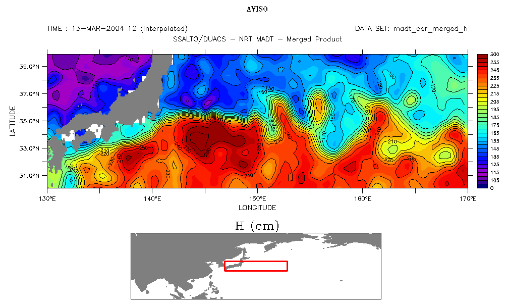
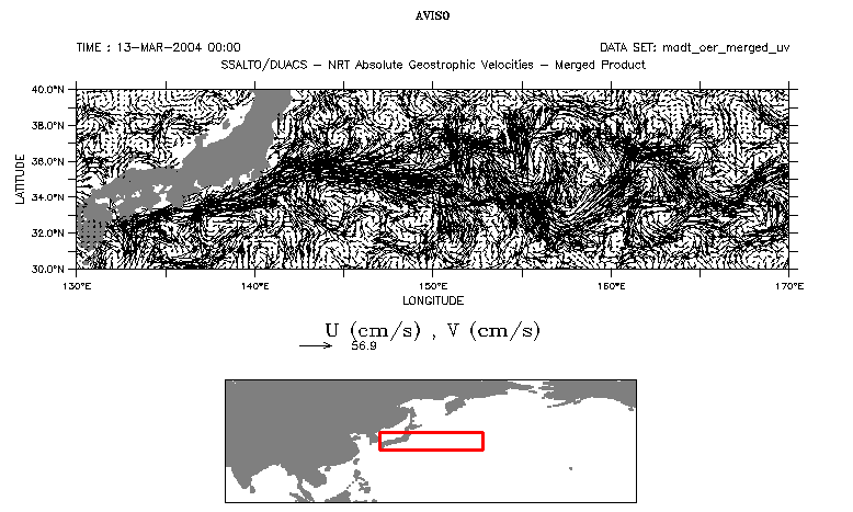
Absolute dynamic topography maps (MADT) and associated geostrophic velocities. Those velocities mustn't be plotted on too big an area, in order to have a significant result via the Live Access Server (see also zooms on 130 - 150°E and 150 - 170°E).
 Use the Live Access Server

