Error is part of data
Lively Data : September 15, 2004
Professors in physics are used to say that a measurement has no meaning without its associated error. Altimetric measurements are no exception. Moreover, for gridded data computed from along-track measurements, you have to take into account the error made by interpoling measurements to have a data even at gridpoints where no measurement is available. Those errors are delivered with the sea level anomaly data available on the LAS ("Formal Mapping Error"), and can be plotted as any other data.
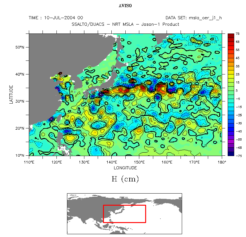
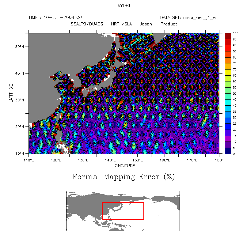

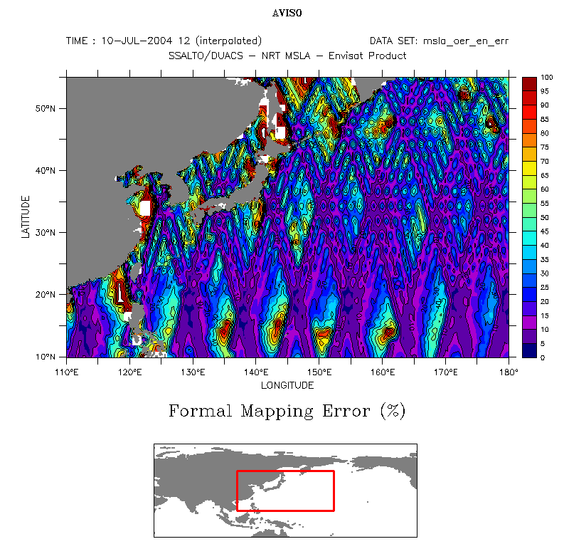
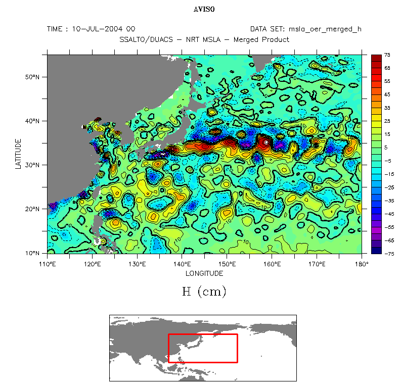

Left, near-real time sea level anomaly data on July 10, 2004 for (top to bottom) Jason-1, Envisat and the four merged satellites (Jason-1, Envisat, GFO et T/P) and right, associated formal mapping error (in percentage of the signal variance) plotted with the Live Access Server. Differences are visible between anomaly maps, and all the more on the error maps, the effects of ground tracks: outside these tracks (i.e. outside satellite measurements), error is much higher. On the contrary, with the data merging the four satellites' measurements, this effect is much smaller and the error is low, except near the coasts.
 Use the Live Access Server

