Geostrophic velocities on the loop
Lively Data : April 20, 2005
The Loop Current is one of the most peculiar currents: it goes in the Gulf of Mexico by the Yucatan Strait (between the Yucatan Peninsula and Cuba, cf Image of the Month, April 2003: A looping current ). From the main currant warm eddies are shredded, around which strong currents turn with a major impact on oil platform operations in the Gulf.
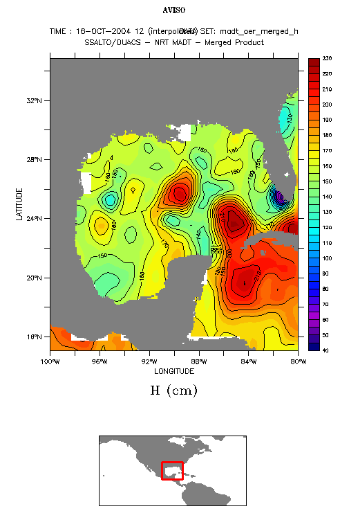
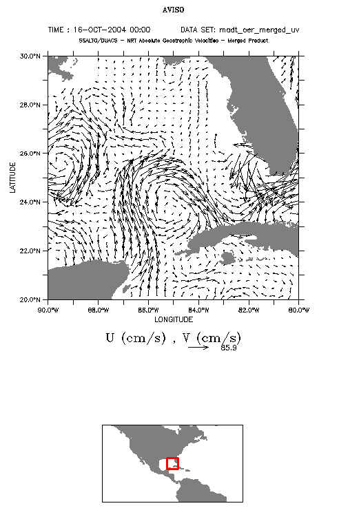
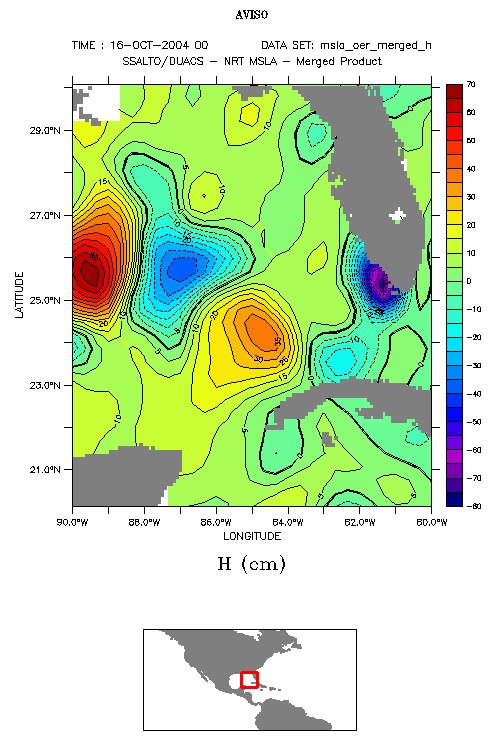
Absolute dynamic topography maps (MADT) on October 16, 2004 over the Gulf of Mexico and associated geostrophic velocities over a smaller area (of 10°x10°). On this latter map the eddy shredding phenomena is much easier to see than on the whole area. Moreover, MADT gives a clearer view of the phenomena than Sea level anomalies (MSLA, map below), which show "only" individual eddies, and not the main current.
 Use the Live Access Server

