The seasons of the Gulf Stream
Lively Data : August 17, 2005
Altimetry data can be studied from a seasonal perspective. On this scale, the variability of certain ocean phenomena, such as the Gulf Stream, is highlighted. We now know that the Gulf Stream is subject to seasonal variations in terms of both geographic location and intensity.
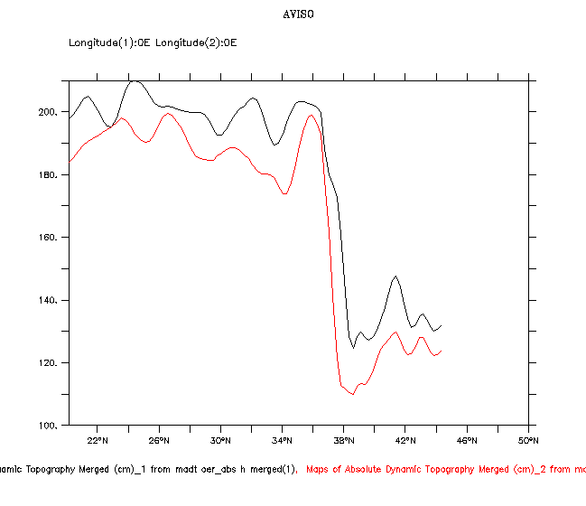
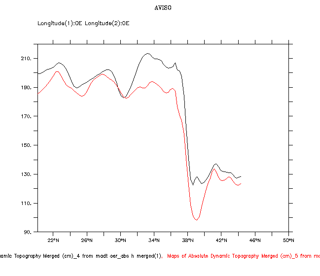
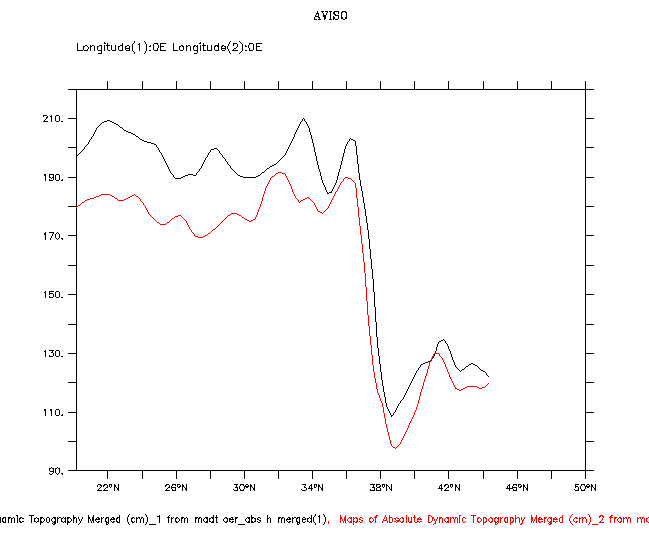
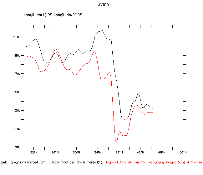
Evolution of Near Real Time Absolute Dynamic Topography (NRT ADT) through the Gulf Stream; the black curves correspond to fall (October-November) and the red curves to spring (April-May). These have been plotted for the periods 2001-2002, 2002-2003, 2003-2004 and 2004-2005 respectively. To do this, the NRT ADT dataset was selected, then on the "Constraints" page,"y line" (ADT-Latitude diagram) was chosen from the "select view" pull-down menu; the longitude was 70°W. The topography data was averaged over two months by selecting "Define variable", "Average" and choosing the data available for the period October to November. The same operation was repeated with the data for April to May. Then via the "compare two" tab, the curves were displayed (these were in the NRT ADT dataset as new variables) in the same window, by selecting "Overlay plot". This same procedure was followed for each year between 2001 and 2005.
Seen in this way, the Gulf Stream (at approximately 37°N) appears further north in October (black curves) than in April (red curves) and also more intense. Shortly after Topex/Poseidon was launched in 1992, it was difficult to determine the cause of these differences: was it a seasonal or inter-annual signal? At the time, not enough observation data were available to conclusively decide. Today, the altimetry data available has widened perspectives for investigation, particularly of ocean interannual variability, which is one of the many keys to climate forecasting.
 Use the Live Access Server

