Averages in slice
Lively Data : November 17, 2005
It is quite easy to use statistics with the Live Access Server, but there are several ways depending on your wishes.
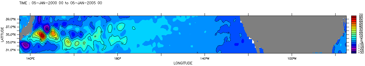
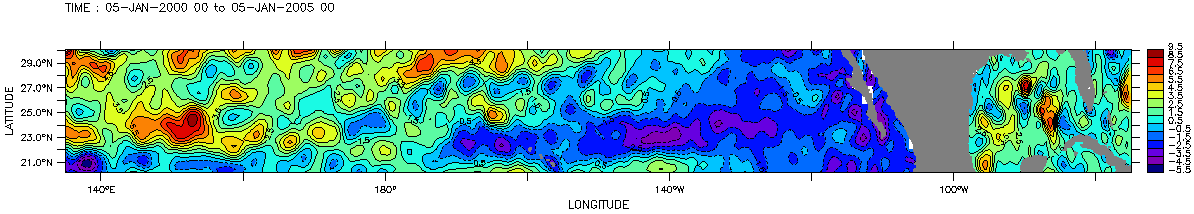
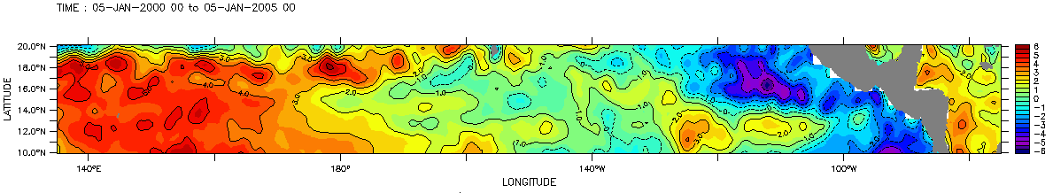
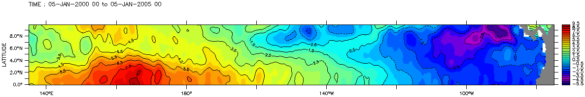
Map of 5 years mean Sea Level Anomalies (in centimeters) in North Pacific Ocean. When "Maps of Sea Level Anomalies Merged" is selected from corresponding Delayed Time dataset, define successively four zonal bands extending 10° meridionally accross the width of the Pacific. For each band select "define variable" menu and "t" to specify temporal period (January 5, 2000 to January 5, 2005), then choose "average" to compute mean SLA.
You can also opt for a temporal vizualisation, for example to study sea level variability with time.
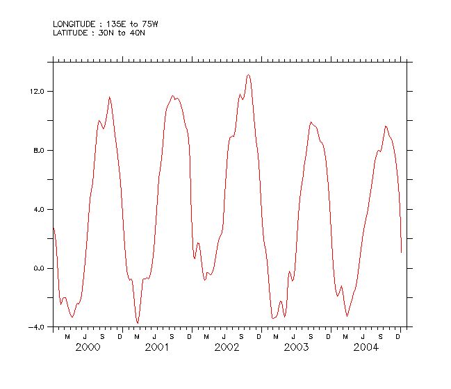
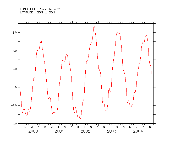

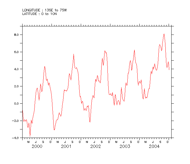
Sea Level Anomalies (in centimeters) averaged for each zonal band, still for the same time period. This time you have to select geographical area and average on both x and y in "define variable" menu. Then LAS "tline" mode is on and allow you to plot this kind of outputs.
Oscillations range varies from Equator to mid-latitudes, which is not obviousness on previous outputs. Values go from approximatively 4 cm on Equatorial band to 8 cm on (30°N-40°N) band. But LAS has other fonctionnalities:
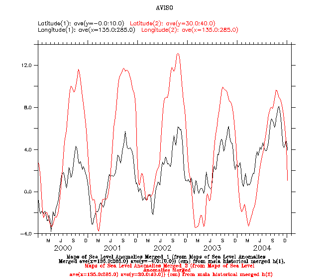
Sea Level Anomalies comparison plot: mean SLA for (0°N-10°N) zone is in black, mean SLA for (30°N-40°N) zone is in red. With LAS, each output is conserved as a new variable; therefore it is possible to use them another time, for exemple to superpose ouput plots on the same axis.
Select "compare two" option; in "Dataset 1-->Variable 1" it is possible to access to previous outputs and select them without computing again (idem in "Dataset 2-->Variable 2"). Finally choose "Overlay plot" as an output.
 Use the Live Access Server

