Anomalies in geostrophic currents
Lively Data : September 15, 2005
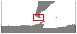
Circumpolar current, during it tour all around Antarctica, goes from Pacific ocean to Atlantic ocean through Drake passage.
Live Access Server enable you to plot two sorts of geostrophic currents: absolute geostrophic velocities or geostrophic velocity anomalies.
Thus you could obtain two differents maps at the same time (for example on January 08, 2005 here), both representing geostrophic circulation.
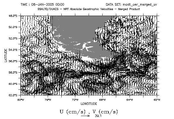
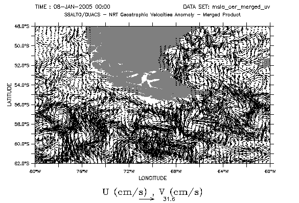
Absolute geostrophic velocities and geostrophic velocity anomalies in Drake passage, January 08, 2005. Choose them among near-real time datasets, then pick "vector (U,V)", and select area (48°S-62°S, 80°W-60°W here).
These maps look the same, but they aren't: each one represents one aspect of geostrophic circulation.
Geostrophic velocity stands for geostrophic current (as derived from the hypothesis of an equilibrium between pressure and Coriolis forces). It is computed using dynamic topography data.
Geostrophic velocity anomaly stands for a variation above total current, and comes from sea level anomalies.
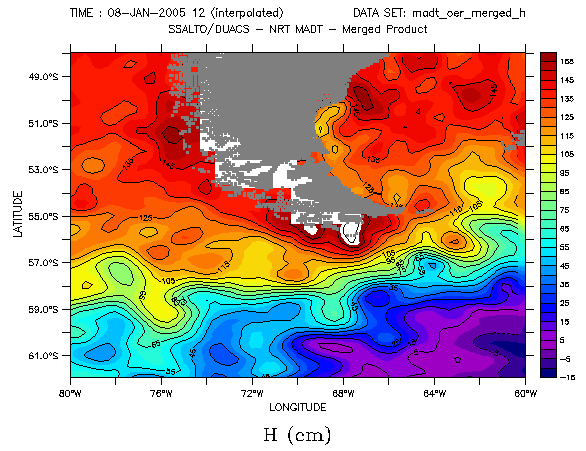
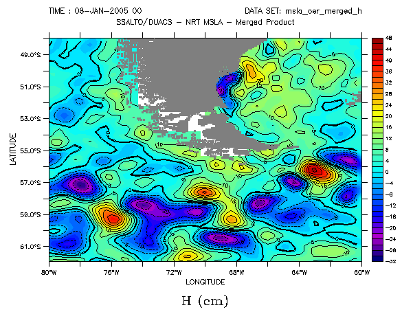
Absolute dynamic topography (MADT) and sea level anomalies in Drake passage (MSLA), January 08, 2005. Choose them among near-real time datasets, then pick merged maps, and select area (48°S-62°S, 80°W-60°W here).
Finally, some aspects related to ocean surface will be displayed depending on the choosen dataset:
- on one hand ocean eddies: current twists and turns because of turbulence
- on the other hand the general flow.
Circumpolar current is a very strong current and carries lots of energy: Drake passage is a very turbulent area. Using geostrophic velocities is not the best way to visualize currents; on the other hand dynamic topography shows circumpolar front separating Antarctic water from Pacific and Atlantic bassin.
 Use the Live Access Server

