Day by day, the Agulhas Current
Lively Data : December 21, 2006
Since last summer Duacs products are available on a daily basis (against 3 days before). The maps are still representative of one day only (even the software uses several weeks of data to produce them), and the temporal sampling gets improved.
Let's consider the example of the Agulhas system, where the rings are the subject of a couple of studies.
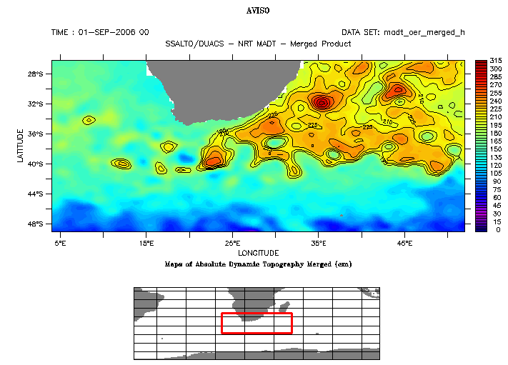
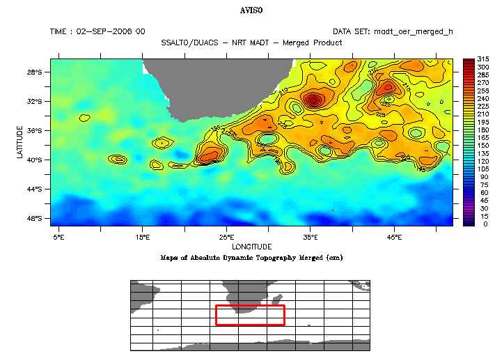
Top: absolute dynamic topography on september 1st, 2006 and september 2nd, 2006.
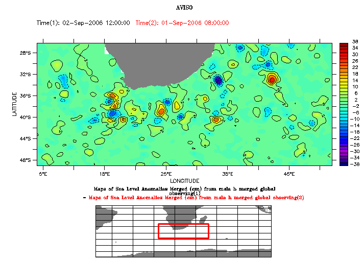
The third plot displays differences between the two maps.
Datasets: SSALTO/DUACS near-real time Absolute Dynamic Topography; variable: Maps of Absolute Dynamic Topography Merged.
To use LAS comparison function, click on "compare two", and take the same data as variables (here "Maps of Absolute Dynamic Topography"). Then, choose two dates, here September 2 and September, 1, 2006. Dynamic topography maps were obtained by setting the color scale to (0,320,5) and the contour levels to (195,320,15).
Note that using sea level anomalies (MSLA) to compute the difference, you would obtain exactly the same map, because MADT = MSLA + MDT.
This example highligths areas where differences between two consecutive days are higher. Differences from one day to another could appear to be not so important; but third map show that these differences can sometimes reach 38 cm, which is not negligeable.
 Use the Live Access Server

