An African monsoon drier than usual
Lively data : December 14, 2007
The monsoon also exists in Africa, and as in Asia, its presence is essential for the people. Using comparison tools, the LAS becomes an interesting way to observe this phenomenon.
The contrast in temperature between the continent (very hot in summer) and the Atlantic Ocean (colder) is at the origin of the African monsoon, which lasts from June to September. The convective systems resulting from this temperature difference move from the Gulf of Guinea up on the continent to create some thunderstorms. According to the results of the "Amma" program, dedicated to the study of this African monsoon, the warming of the Atlantic waters is one of the factors of the irregular monsoon and of the droughts observed.
Maps of Sea Level Anomalies (SLA) averaged from the beginning of June until the end of September for years 2005, 2006 and 2007 (below) clearly highlight the warming of the ocean waters in the Gulf of Guinea during years 2006 and 2007 (a late monsoon was observed during these 2 years). On the contrary, the ocean waters were colder in 2005.
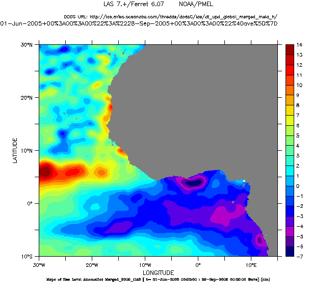
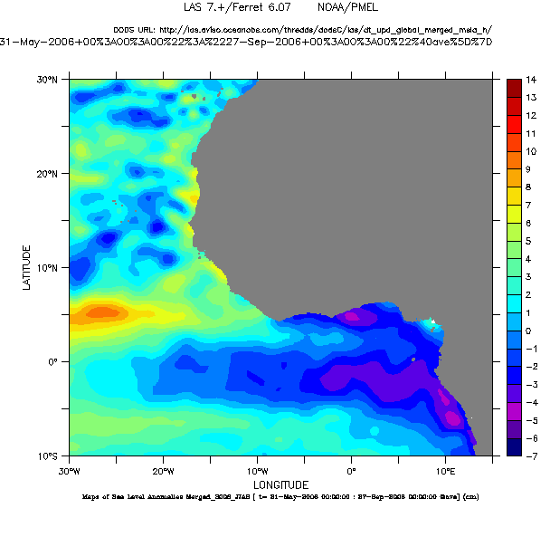
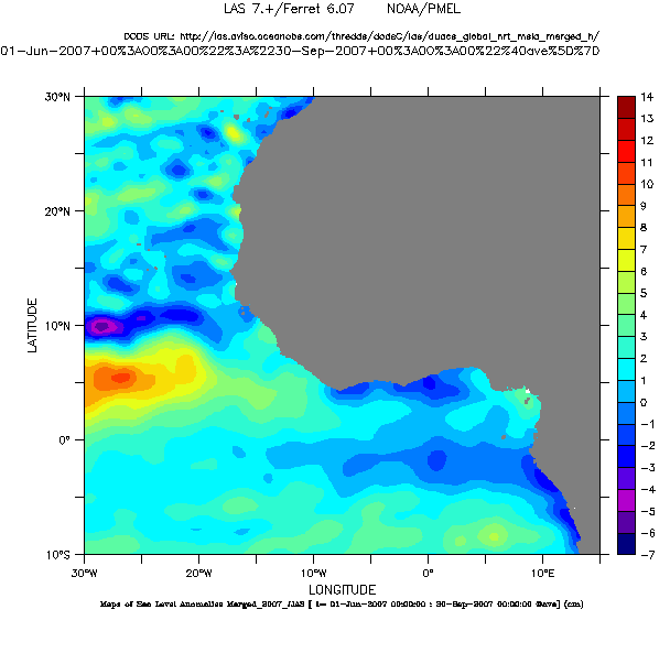
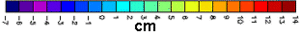
Maps of Sea Level Anomalies (SLA) averaged from June to September for 2005, 2006 and 2007 in the Gulf of Guinea. Choose NRT - Global - (Maps of) Sea Level Anomalies then, in Define variable and Select analysis type, select Average and finally in Apply to these axes, click on "T". Choose also the period and the geographical area. Sature the color palette in Select options and Color fill levels (-7,14,1) in order to compare the 3 years.
See also :
- Lively Data, May 23, 2005 : Looks on Indian monsoon.
- Research program Amma.
 Use the Live Access Server

