Ocean circulation in the Solomon Sea
Lively data, April 16, 2010
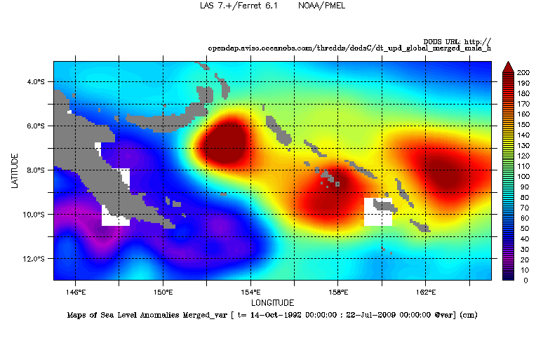
The Solomon Sea is located on the western boundary of the Pacific Ocean at the northeast of the continent of Oceania. This is a key area where currents redistribute water from the subtropics to the equator. Numerous islands and hilly bathymetry involve a complex circulation.
Its main inflow circulation is fed by the New Guinea Coastal Current (NGCC), itself fed by the South Equatorial Current (SEC) and North Queensland Current (NQC). Outflow waters go by Vitiaz and Solomon Straits to reach the Western Equatorial Pacific. This area knows an important SLA variability, easily shows by the LAS. The most strong variability occurs in the eastern Solomon basin.
The geostrophic velocities anomalies show a high activity just in front of the Solomon Strait. This feature is particularly important when a transition period between El Niño/La Niña episodes occurs (like on the map on 1998/10/14 below). It is hypothetisized (Gourdeau et al.)that the entering flow by the south can not easily exit by the straits inducing an energy dissipiation through high eddy activity. On the opposite, during another period (here on March 2010), the outflows are highly visible going by the straits.
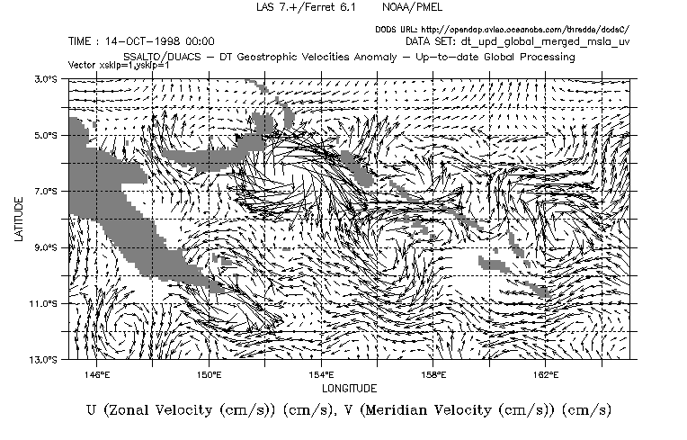
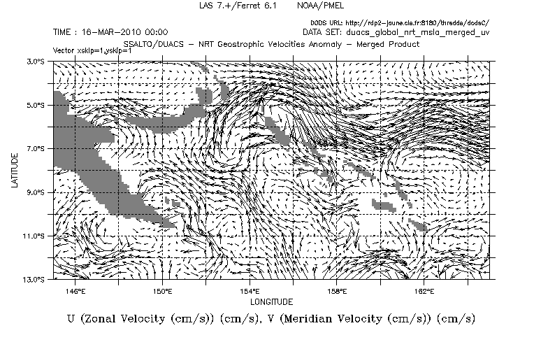
Maps of geostrophic velocity anomalies in cm/s the 14 October 1998 (left) and the 16 March 2010. Choose DT - Global- Maps of Geostrophic Velocity Anomalies, Variable(s): Vector (U,V), the date, and the geographical area.
Further information:
Image of the month, November 2007: The ocean is going up and down around the Solomon Islands
L. Gourdeau et al., Variability of the Solomon Sea circulation from altimetric sea level data, poster presentation at OSTST Seattle (2009).
website : Oceanic Circulation in the Solomon Sea and Coral Sea
 Use the Live Access Server

