Cold winter and negative North Atlantic Oscillation index
Lively Data: December 17, 2010
As the winter of 2009-2010, the beginning of this 2010-2011 winter is unusually cold over Europe. As the winter NAO index was largely negative in 2009-2010, this index is already negative during the last months of 2010. Does it suggest the same colder winter for the next months ?
The NAO index measures the difference of atmospheric pressure between the Azores anticyclone and the low-pressure system over Iceland. Its fluctuations have a direct impact on the climate of Europe, particularly in Western Europe. During a negative phase (Azores high, Iceland low, like in 2009-2010 and end 2010), westerlies winds over North Atlantic ocean are weaker, bringing less moisture in the air to northern Europe, and less heat. This situation allows cold air into Northern Europe from the cold Siberian anticyclone.
By comparing the ocean situation in 2009-2010 and the situation today, some sights are similar.
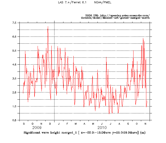
The time serie of the SWH averaged over a northern area (22°W/18°W/55°N/59°N) highlights high SWH during the end of 2009 (almost 7.5 m early in December 2009) and the end of 2010 (almost 6.5 m early in November 2010).
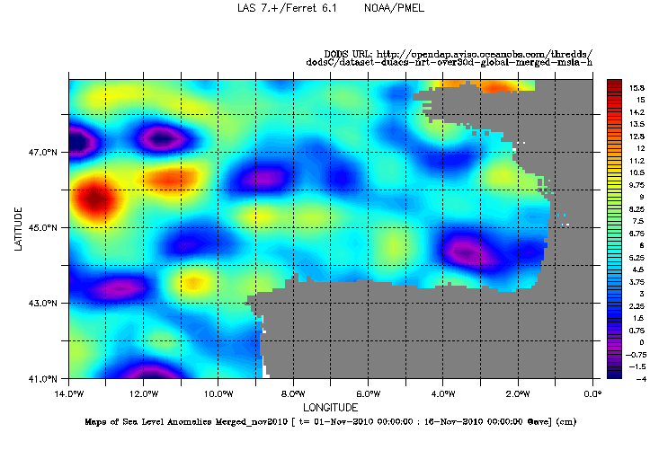
Numerous swoddies are observed off Northern Spain. These structures are correlated with low values of the NAO (see our Lively Data in February 24, 2010: Navidad current and North Atlantic Oscillation).
 Use the Live Access Server

