Eddy activity in South China Sea
Lively Data, March 26,2010
The South China Sea is a large semi-enclosed sea where the seasonal circulation is driven by the asiatic monsoon system. Wind stress, intrusion of the Kuroshio near the Luzon Strait and the interaction between shelf currents and the bottom topography create short and long-lived anticyclonic and cyclonic gyres.
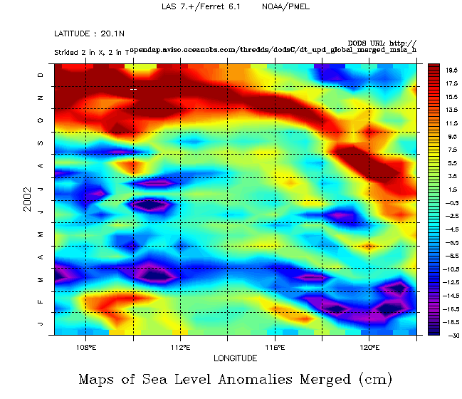
A longitude-time hofmoeller diagram on the 20°N latitude (here for the 2002 year) gives an idea of the eddy activity for both the spatial and time components. The eddies circulate wesward. During February-March, cyclonic eddies are predominant while during August-December, anticyclonic eddy are the most widespread. A lower eddy activity is observed during May (explained by a weaker wind stress during this transition period).
But the spatial configuration of this enclosed sea with some islands limits its observation by satellite altimetry. By combining several altimetry missions with different spatial resolution multiply chances of tracking eddies. On the Map of Sea Level Anomaly on 2010/02/16, around the 113°E, 13.8°N point (point marked with the black cross below) no eddy is observed by Jason-1 alone while an eddy core is tracked when Jason2, Jason-1 and Envisat are used together.
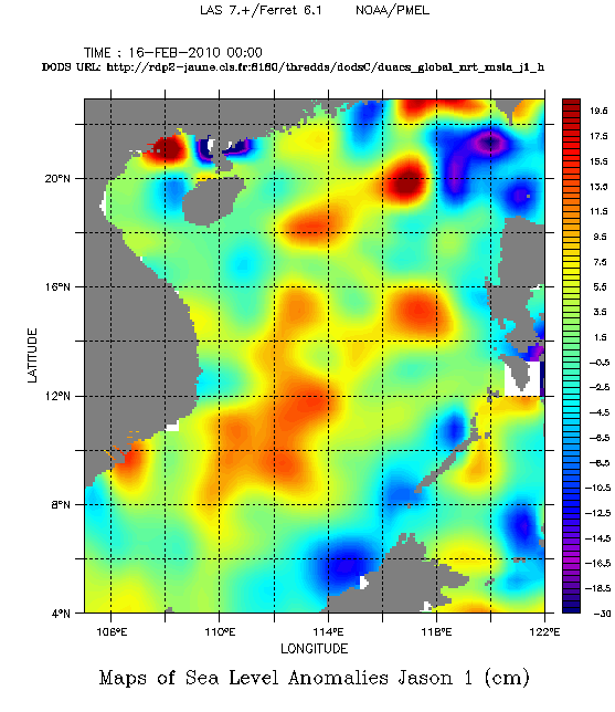
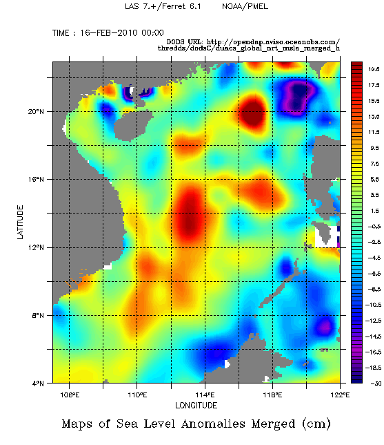
Maps of merged Sea Level Anomalies (SLA) in cm the 2010/02/16 in the South China Sea for Jason-1 (left) and Merged data (right). Choose Near-real time Data, Global, (Maps of) Sea Level Anomalies, the area and the date.
Further information:
- Altimetry: High-precision altimetry with satellites working together
Xiu, P., F. Chai, L. Shi, H. Xue, and Y. Chao (2010), A census of eddy activities in the South China Sea during 1993–2007, J. Geophys. Res., 115, C03012, doi:10.1029/2009JC005657.
 Use the Live Access Server

