A lake capped by ice
Image of the Month - August 2000
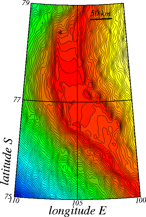
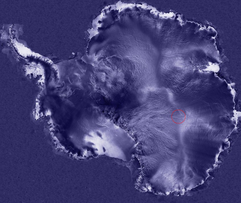
Lake Vostok is a liquid, freshwater lake lying under a three-kilometer blanket of ice in the middle of the Antarctic continent. Here, rather than deforming as it flows (with the steepest slope, from right to left in the image), the ice sheet slides over the water, forming a plateau 40 kilometers across and 100 kilometers long. We have been able to observe this plateau thanks to topographic measurements by the radar altimeter on board the ERS satellites (see Rivers of ice in Antarctica).
Lake Vostok is of great interest to researchers seeking to retrace the history of Earth's climate, as its waters could hold the key to what climate was like several million years ago. Ice cores have already been recovered from the area (marked by the star on the map), but operations have now stopped until we can develop drilling techniques that will enable us to breach the lake's surface without contaminating it. Analyzing these ice cores from deep below the surface allows us to study climate evolution over a period of several million years.
Studying climate history is vital if we are to gain a closer insight into climate variations. By combining this knowledge with altimetry and other data and assimilating it into models, we will be able to predict likely climate changes in the relatively near future.
See also:
- Applications: Ice
Websites on this subject:
- Climates et paleoclimates
- Paleo Global Warming Home (Noaa)
- Lake Vostok and observation of the Antarctic

