Routing ships with the currents
Image of the Month - April 2011


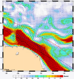
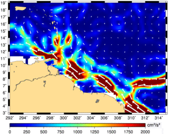
Most of the goods transported across the world are loaded on a ship at some point or the other. So about 3 to 5% of CO2 emissions are due to merchant ships, and, moreover, their fuel is very heavy in sulfur, thus leading to substantial pollution. Several ideas are under study to decrease this (especially with the perspective of an increase in marine shipping in the next decades). One of the ideas that can already be applied is the optimization of the ship paths. Weather routing, i.e. optimization of a ship path following the weather conditions is quite commonplace. But oceanic routing can also be proposed, with the course optimized with respect to the surface currents.
Using ocean models like Mercator, which assimilate altimetry data on an operational basis, best routes are proposed to shipping companies and their captains. Depending on the areas, the conditions and the currents, fuel saving can go up to 8% (on average about 4%).
See also:
- Image of the Month, January 2008: Like a stone carried away by the current
- Applications / Ocean: Operational oceanography


