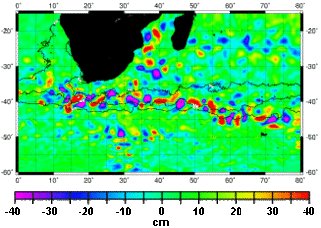
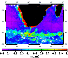
The Agulhas system is a key region for understanding how the ocean affects global climate on two counts: first, because it transports warm waters from the Indian Ocean towards the Atlantic, thus maintaining the global thermohaline circulation; and second, because it plays an active role in the carbon cycle by absorbing carbon dioxide. The frontal system formed by the Agulhas Return Current and the subtropical convergence zone is an area of intense mesoscale activity that is teeming with life and chlorophyll a.
Only by combining complementary information about dynamic topography, sea surface temperature and ocean color derived from simultaneously acquired satellite data will we obtain dynamic scenarios better able to describe the spatial and temporal variability of phytoplankton distribution.
Altimetry and ocean color. The most turbulent zones (hills in red and valleys in mauve on the map of residual sea surface heights derived from altimetry, on the left, in centimeters) are where biological activity is most intense (in red on the ocean color map: quantity, in milligrams, of chlorophyll a per cubic meter of water). (Credits Legos).
See also
- Applications: Mesoscale circulation.
- Image of the month : Where currents meet


