
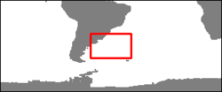
Brazil-Malvinas Confluence region
Image of the month - February 2005
Image of the month - February 2005
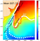
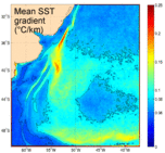
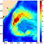
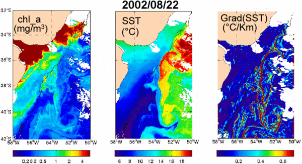
The region of Confluence of the Brazil and Malvinas Currents (Southwest Atlantic) is a very energetic complex region. Contrasts in sea surface temperature, in Chlorophyll-a concentration and the local maximum in eddy kinetic energy make satellite infrared (IR) color imagery and satellite altimetry particularly appropriate tools to study the Confluence region.
Data from satellites provide valuable information in this area, which, like most of the southern hemisphere oceans, has few in situ time series observations. Satellite data provide information about spatial scales as small as 1 km (e.g. filaments are visible with MODIS) to several hundred of kilometers (Zapiola Rise) and from time scales of 24 hours to more than 10 years.
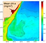
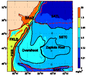
These means fields allow to establish biophysical provinces in the South West Atlantic ocean:
- Background colors represent the six ranges of chl-a magnitudes identified with an histogram method.
- Regions obtained (solid black lines) retrieves Longhurst (1998) Provinces (dash-dot red lines).
- Three new provinces are identified: the Overshoot, the Patagonian Shelf Break (PSB) and the Zapiola Rise Provinces (Saraceno, 2005).
SATL: South Atlantic Gyral Province
SSTC: South Subtropical Convergence Province
BRAZ: Brazil Current Costal Province
FLKD: Southwest Atlantic Shelves Province
SANT: Subantartic Water Ring Province
References
- Saraceno, M., C. Provost, A. R. Piola, J. Bava, and A. Gagliardini, Brazil Malvinas Frontal System as seen from 9 years of advanced very high resolution radiometer data, J. Geophys. Res., 109, C05027, doi:10.1029/2003JC002127, 2004.
- Saraceno, M., C. Provost, A. R. Piola, On the relationship of satellite retrieved surface temperature fronts and chlorophyll-a in the Western South Atlantic, JGR, 110, C11016, doi:10.1029/2004JC002736, 2005.

