Combining the close-up view with the big picture
Since the middle of the 19th century, the North Atlantic Oscillation has been measured from land and, increasingly, at sea. In recent years, satellites have made it possible to monitor this phenomenon continuously and systematically.

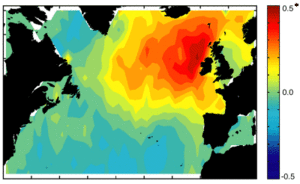
NAO as seen by altimeters
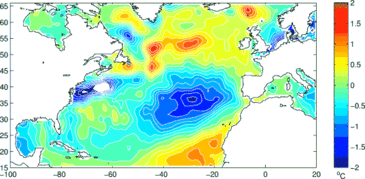
The fluctuations of the North Atlantic Oscillation and the temperature variations that go with it lead to changes in sea level. The ocean reacts to shifts in the prevailing winds, which drive the currents, waves, sea surface temperature... Temperature swings also cause sea surface height to vary. We can observe these variations using altimetry satellites such as Topex/Poseidon and Jason-1. All these measures can thus serve as indicators for NAO phases and be used in climate prediction models.
Other satellites observe sea surface temperature and wind speed, from which we can derive information about heat exchanged between the ocean and atmosphere. By combining these data acquired over relatively long periods with in-situ measurements deeper down, we are beginning to understand what role the ocean plays in the NAO.
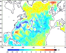
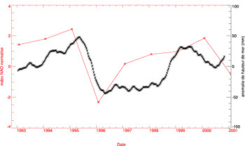
1995 - 1996, a sharp variation
Between the winters of 1995 and 1996, sea level rose around Iceland and fell further south. The NAO index for the same period also varied sharply. This swing causes the westerly winds around Iceland to weaken, which in turn leads to rising temperatures in the upper layers of the ocean. In-situ measurements suggest that such temperature fluctuations could be largely responsible for variations in sea level.