Thermohaline Circulation
The one major drawback of observing the oceans from space is that electromagnetic waves emitted and received by the satellite do not penetrate far beneath the sea surface. Altimetry satellites do measure range from the satellite to the surface, but the estimated sea surface height also comprises the cumulative impact of many phenomena over the whole water column. Thus we can deduce from these measurements what's happening in the depths.
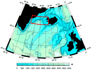
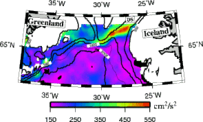
Denmark Strait, between Greenland and Iceland is like a sill (left: bathymetric map) southward which cold water sinks. There, an altimetric map show strong turbulence, without matching surface process (Kinetic energy map deduced from altimetry, right). (Credits KMS).
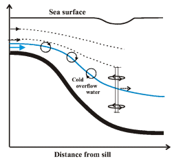
The Greenland sea is a key zone of planetwide ocean circulation, i.e. thermohaline circulation. There, cold and salty Atlantic waters sink to the bottom of the ocean, like a waterfall. Descending, cold water mixes with ambient one, creating subsurface eddies that altimetry data analysis able us to detect.
See also:
- Applications: Who leads the dance?
- Applications : Tides and climate
Websites on this subject:
- Thermohaline circulation
- Atlantic thermohaline circulation (Clivar) - Deep water
- Overflows in the Atlantic

