Tracking El Niño
Lively Data : July 21, 2003


El Niño is one of the most monitored ocean phenomena (see Applications: El Niño). The 2002-2003 event thus was spotted very early, on the sea level anomalies maps (especially those from Near-real time data such as Ssalto/Duacs), and was monitored all along 2002 (see the "El Niño bulletin")
The LAS able to see this phenomenon on the sea level anomaly maps. A specific area "Equatorial Pacific" is predefined, and maps can be drawn for every week from August 2001. To better estimate the evolution between two dates, there are comparison functions in the LAS.
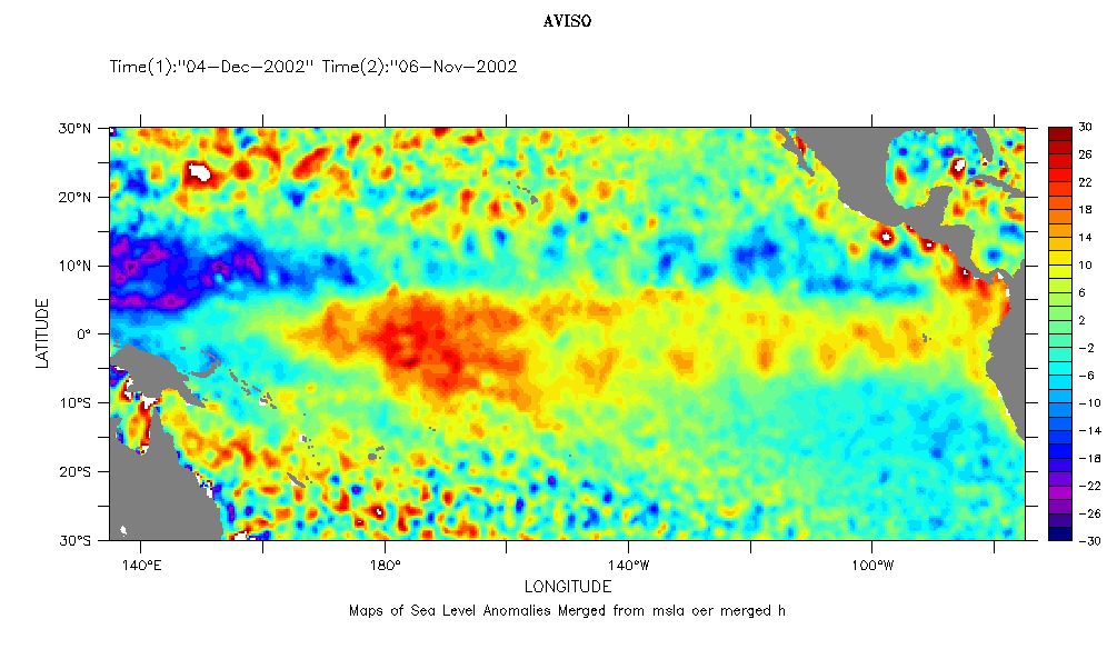
To use LAS comparison function, click on "compare two", and take the same data as variables (e.g. here "Maps of Sea level anomalies - Merged"). Then, choose two dates, here November 6 and December 4, 2002. Three comparison functions are available as outputs: difference ("comparison plot", 1st data minus 2nd data), overlay (mostly useful to compare two different datasets on a same period), and visual comparison (adjacent plot).
After setting the color scale to (-30,30,2), you can have the maps right; Top, difference (December 4 minus November 6), where you can see that the phenomenon intensity decreased in a month; middle, November 6 map and bottom December 4 one)
(Click on the map to enlarge them).
 Use the Live Access Server

