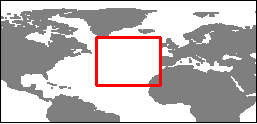
North Atlantic sea level heights over time
Lively Data : February 18, 2004
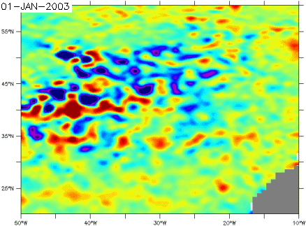
Oceans have their seasons (see Applications: Ocean seasons), shifted of about two monthes with respect to their atmospheric equivalents, time for water to warm up or cool down. Water dilatation and contraction due to those warming and cooling can make sea surface heights vary of about 10 cm between the coldest month (April-May) and the warmest (September-October).
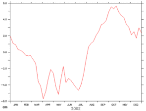
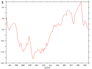
Merged sea level anomaly average evolution over the same area of the North Atlantic in 2002 (left) and 2003 (right). A seasonal cycle is clearly shown, shifted with respect to the atmospheric seasons.
Plotting such curves is possible with the Live Access Server, by using the "define variable" function, that able you to average data over a geographical area and to plot its evolution over time (see Lively data for October 20, 2003: "Averaging an area").
 Use the Live Access Server

