Direct access to the data behind the LAS
Lively Data : March 18, 2004
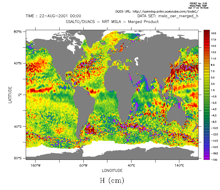
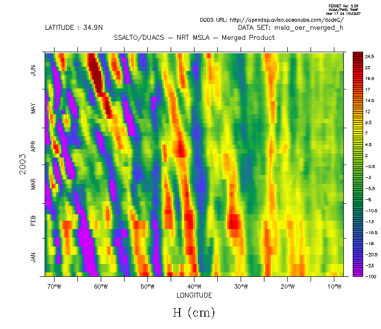
Merged sea level anomaly map and Hovmoller diagram plotted by Ferret (and not throught the LAS!) directly from the Aviso OpenDap.
If you wish to use data time series, make computations and/or plot your figures with your favorite program, the best is to use the OpenDap (http://opendap.aviso.oceanobs.com, cf Digging into the data, September 8, 2003), the database that provides data to the Live Access Server for its plots.
For example, to use directly merged sea level anomaly data (merged MSLA) with Ferret software :
- launch Ferret
- type :
use "http://opendap.aviso.oceanobs.com/dodsC/merged/h/msla_oer_merged_h"
then "show data" shows the file characteristics.
Data are in "grid_0001". This grid includes all available msla_oer_merged_h data from the beginning (August 2001). "show grid grid_0001" returns number of points, beginning and end value, in longitude, latitude and time. grid_0001 can be used as a local data source; network access are completely transparents, and concern only selected data.
For more information, look at the command lines that were used to plot figures above.
You thus can plot a map, a longitude-time diagram, etc. What can be done with Ferret is also possible with other software (see OpenDap website for software list).
 Use the Live Access Server

