In Indian Ocean
Lively Data : May 24, 2006
Among all altimetry products available via the Live Access Server, and unlike Ssalto/Duacs products, wind/wave maps represent the whole five days used in the product generation.
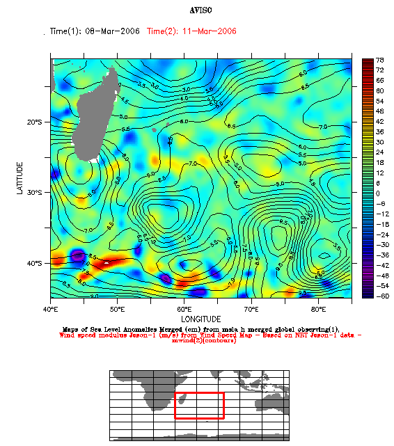
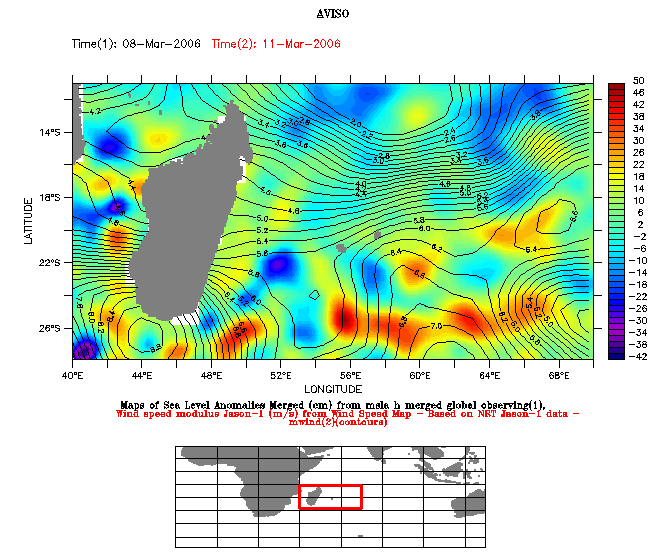
Left and right: maps of Sea Level Anomaly and wind speed modulus, from March 8 and March 11 2006 respectively.
To plot such maps, choose a variable (here, Near-Real Time Maps of Sea Level Anomaly), clik on "compare two" in the left side menu, and choose the second variable (here Jason-1 wind speed modulus). Then, you can select "Overlay plot" output, with the MSLA in color and wind speed as contours. Dates for each dataset are available in "constraints" menu.
March is the hurricane season in Indian Ocean:
- On the 8 of March, MSLA map presents a few eddies on the bottom (left figure), probably due to Aghulas system; we can notice a high anomaly located at (26°S,56°E, right figure): it seems to be a signature of strong tropical storm Diwa (55.43°S-58.80°E, 26.46°S-30.81°S on March 08, 2006 from Meteo France sources).
- wind fields have strong values around three main structures (approximately 30°S-42°S, 55°E-80°E); these values represent the wind measured on the whole period from March 7 to March 11, so the map is an indicator of the wind distribution on this period. This wind distribution also seems to well correspond with Diwa hurricane's trajectory.
New merged wind/wave maps will soon be available on the Live Access Server: this product, which represent the last two days of measurement, will probably contribute to improvements in our marine meteorology knowledges.
 Use the Live Access Server

