Black Sea : a new regional product for the LAS
Lively Data: April 17, 2009
After the Mediterranean Sea products, the LAS now includes a new regional product for the Black Sea. This new regional product shows a high spatial resolution with a mesoscale pattern well defined.
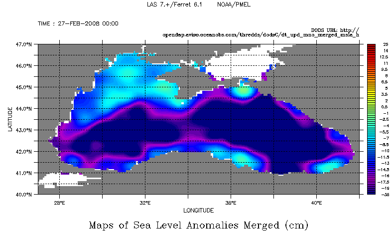
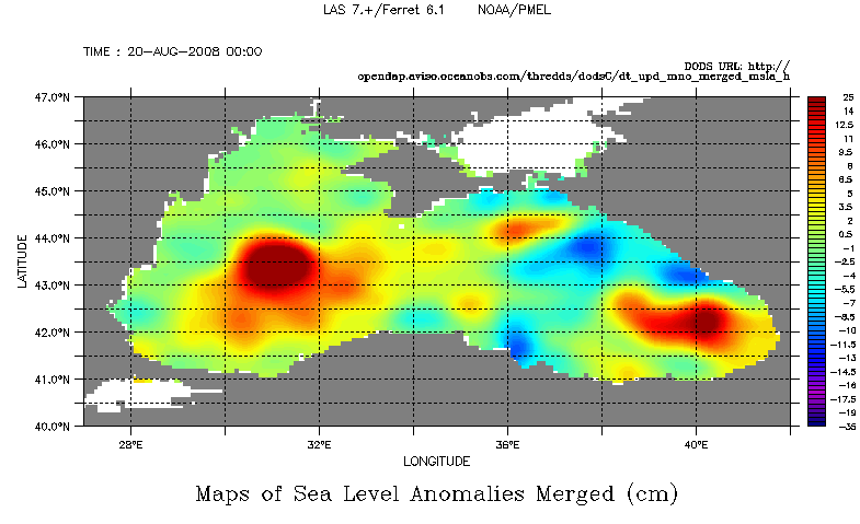
Maps of Ssalto/Duacs merged Sea Level Anomalies in the Black Sea for the 27th February 2008 (left) and the 20th August 2008 (right). To plot such a map, you have to select the dataset Delayed-time, the regional product, i.e. Black Sea, the variable (here Maps of SLA merged), choose the date and define a common color fill levels (-35)(-20,15,0.5)(25).
The predominant circulation -the RIM current- is cyclonic and entire encircles the Black Sea on the deeper areas. It generally flows along the continental slope and shows strongly seasonnal variability. The RIM current is most intense during Winter-Spring season. Maps of Sea Level Anomalies during winter season (left map) highlight the differences between the open and coastal zones. The highest negative sea level anomalies are on open sea and contrasted with less negative values or positive values on the continental shelves.
A strong mesoscale activity takes place at the periphery of the RIM current in the coastal sea within well identified anticyclonic eddies. A map of SLA during summer season shows the Batumi eddy in the southeast sea and the Sevastopol eddy in the western sea which are the most important and well-known. They appear each year but show a significant interannual variability.
Further information:
- Image of the month, March 2008: Black Sea's eddies.
- Data: Black Sea MSLA & geostrophic velocity anomalies
- G. Korotaev, T. Oguz,A. Nikiforov and C. Koblinsky: Seasonal, interannual, and mesoscale variability of the Black Sea upper layer circulation derived from altimeter data, Journal of Geophysical Research, Vol. 108, No. C4, 3122, doi:10.1029/2002JC001508, 2003.
 Use the Live Access Server

