Meddies in Atlantic Ocean
Lively Data, June 18, 2009
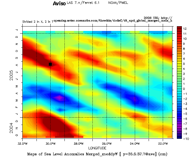

'Meddies' (Mediterranean eddies) are defined as warm and salty eddies of Mediterranean water sinking in the northeast Atlantic through the Gibraltar Strait. They are generated by the interaction of the Mediterranean Waters with the bottom topography. Even they propagate at mid-depth northward or westward, they have a significant signature on the sea level profile that the satellites altimeter can detect. They are generally anti-cyclonic (they rotate in a clockwise direction) and correspond to a positive sea level anomaly with about several cm of amplitude.
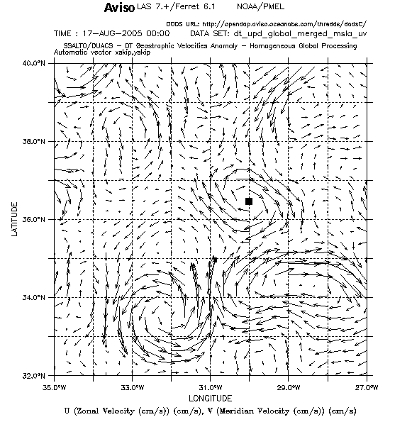
Using the LAS, Maps of Sea Level Anomalies showing evolution wrt to longitude and time or maps with geostrophic currents can help to show these meddies or detail their characteristics (number, size, main trajectory, temporal evolution, ...). One example is given to the South of Azores (near 30° W, 36°N) in the Atlantic Ocean with a meddy visible on a Hovmoeller diagram including MSLA data (top). It moved over ten degrees of longitudes (22°W - 32°W) during more of one year (October 2004 - November 2005). A map with geostrophic current anomalies (bottom) corresponding to one date and one spot of this diagram (represented with little black squares) shows an instantaneous picture of this meddy just to the north to the Azores current (represented with red lines).
Further information:
- Applications: Mesoscale circulation
- Mercator Océan, Mediterranean waters swirling into the Atlantic, with the collaboration of Yann Drillet (Oct.2005).
- Bashmachnikov F., et al. (2009), In situ and remote sensing signature of meddies east of the mid-Atlantic ridge, J. Geophys. Res., 114, C05018, doi:10.1029/2008JC005032
 Use the Live Access Server

