Science orbit
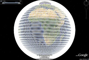
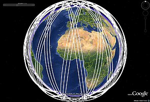
Swot science orbit has been a non sun-synchronous 21-days orbit, at 890.6 km with an inclination of 77.6° starting from July 21st, 2023. The wide-swath enables a more complete ground coverage than previous, nadir, altimeters.
Orbit requirements


- Global coverage and more frequent sampling dictates a compromise in orbit repeat period of 21 days with 10-day subcycle.
- Inclination of 77 degrees to achieve non sun-synchronous orbit to minimize tidal aliasing and to ensure coverage of major water bodies on land.
Orbit characteristics
| Science orbit | |
| Repeat orbit parameters (N+P/Q) | 13+19/21 |
| Mean semi-major axis (m) | 7268718.9 |
| Altitude (km)(mean sma minus equ. radius) | 890.582 |
| Inclination (deg) | 77.6 |
| Mean Eccentricity | 0.00105 |
| Number of orbits per cycle | 292 |
| Nodal period (sec) | 6173.62 |
| Exact repeat cycle duration (days) | 20.86455 |
| Longitude gap between 2 consecutive ground tracks (deg) | 25.890 |
| Longitude gap between 2 adjacent ground tracks (deg) | 1.233 |
| Drift of Right Ascension of Ascending Node local time(minutes/day) | -9.35 |
| Duration for 24h Right Ascension of Ascending Node local time change (days) | 154.0 |
Reference orbit files
The longitude offset has been chosen so that one science pass is aligned with CalVal pass n°3 (see CalVal orbit)
Ephemeris files (.txt)
Ephemeris in terrestrial frame.
Ephemeris length = 21 days (1814400 seconds , time-step = 30 seconds
- ephem_science_sept2015_pv-v2.txt : position and velocity
=> time (s), x (m), y (m), z (m), vx (m/s), vy (m/s), vz (m/s)
- ephem_science_sept2015_ell-v2.txt : geodetic coordinates (/ WGS84)
=> time (s), longitude (deg), latitude (deg), altitude / ellipsoid (m)
- ephem_science_sept2015_sph-v2.txt : spherical coordinates
=> time (s), longitude (deg), latitude (deg), radius (m)
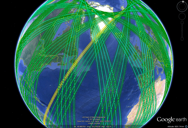
Ground track and Swath files (kml & shapefiles)
- Nadir ground tracks: swot_science_orbit_feb2025-v1.0_10s_nadir.kml
- Open Ocean (lower resolution "LR") Swot data coverage, 10 s time step
- Open Ocean (lower resolution "LR") Swot data coverage, 30 s time step (lighter files, but less precise, especially at high latitudes)
- Land waters and coastal (higher resolution "HR") Swot data theoretical coverage, 10 s time step
- Land waters and coastal (higher resolution "HR") Swot data seasonal (Dec-Feb) theoretical coverage, 10 s time step, as of Dec. 1st, 2024.
Cross-overs times & passes
For each latitude (North as well as South), the number of passes and the time difference between the ascending and the descending passes at the crossovers are computed.
See the kmz file for an overview of those crossovers, and the xls file for a complete list (only 8 of them listed below)
| Latitude (degrees N or S) | minimum Difference in passes | minimum time (s) | minimum time (days) | minimum time (hh:mm:ss) | supplement in passes to the cycle | supplement in time (s) to the cycle | supplement in time to the cycle (days) | supplement in time to the cycle (hh:mm:ss) |
|---|---|---|---|---|---|---|---|---|
77.3185 | 3 | 6273 | 0 | 01:44:33 | 581 | 1796424 | 20 | 19:00:24 |
76.2644 | 5 | 12556 | 0 | 03:29:16 | 579 | 1790141 | 20 | 17:15:41 |
74.1378 | 7 | 18867 | 0 | 05:14:27 | 577 | 1783830 | 20 | 15:30:30 |
70.0412 | 9 | 25239 | 0 | 07:00:39 | 575 | 1777458 | 20 | 13:44:18 |
61.1151 | 11 | 31774 | 0 | 08:49:34 | 573 | 1770923 | 20 | 11:55:23 |
33.4475 | 13 | 38959 | 0 | 10:49:19 | 571 | 1763738 | 20 | 09:55:38 |
38.1448 | 15 | 47639 | 0 | 13:13:59 | 569 | 1755058 | 20 | 07:30:58 |
62.3626 | 17 | 54703 | 0 | 15:11:43 | 567 | 1747994 | 20 | 05:33:14 |
| ... | ... | ... | ... | ... | ... | ... | ... | ... |


