Latest News
29.02.2024 SWOT: Public release of the L2 NADIR GDR (NALT) and AMR products

The Surface Water and Ocean Topography (SWOT) project is pleased to announce the public release of the Level 2 Geophysical Data Record (GDR) products from the onboard nadir altimeter (NALT) and advanced microwave radiometer (AMR).[more]
12.02.2024 Swot monitors its first El Niño
 for cycle 6 (November 2023), without interpolation. The consistency of the observations means that the data can be plotted as they are. (Credit: Cnes/CLS/JPL, image Aviso)")
The current El Niño event is the first to be "seen" by SWOT over the period of its maximum development.
09.02.2024 New Sargassum Floating Algae Index datasets available
Three datasets are added to the catalogue: 1/daily operational hr Sargassum Floating Algae Index using Sentinel-2A&B and Landsat-8&9 satellites, 2-3/daily operational hr and lr Sargassum Floating Algae Index using Sentinel-3A&B...[more]
06.02.2024 Currents in 2 dimensions
 (Credit Cnes/CLS/JPL)")
Swot provides natively its measurements in two dimensions along its two swaths, so that geostrophic currents can be directly derived from them.
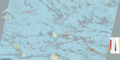
01.02.2024 February 2024: a turtle in the English Channel's tidal currents

Marine animals such as sea turtles are subject to currents, tidal ones included. Their knowledge can help in protecting those endangered species.

