News
Flood and high waters over the Garonne river basin
Satellites show high waters and floods over the Garonne river and its tributaries late January - beginning of February 2021
|
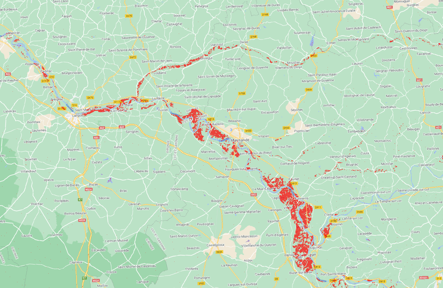
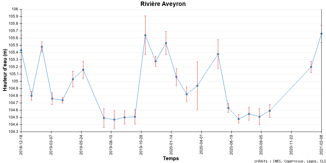
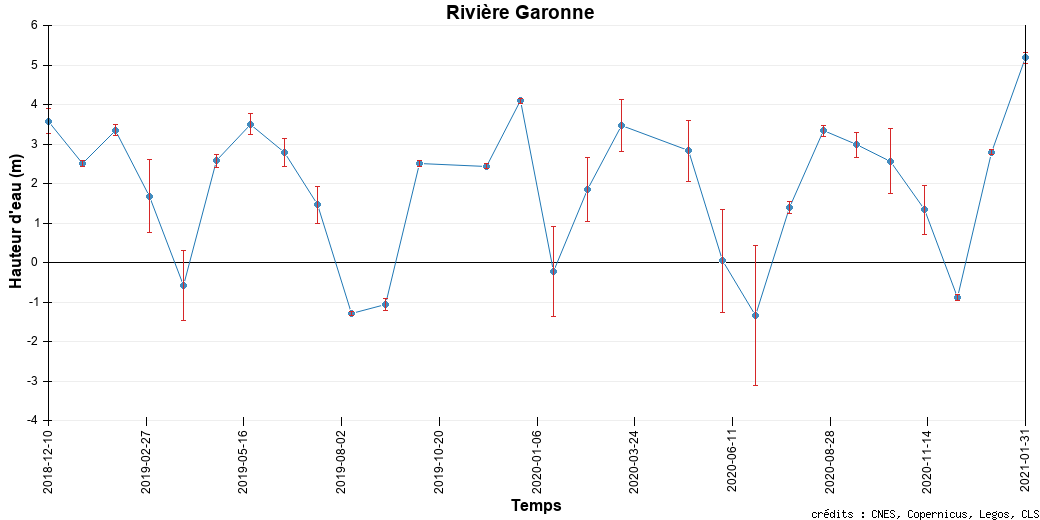
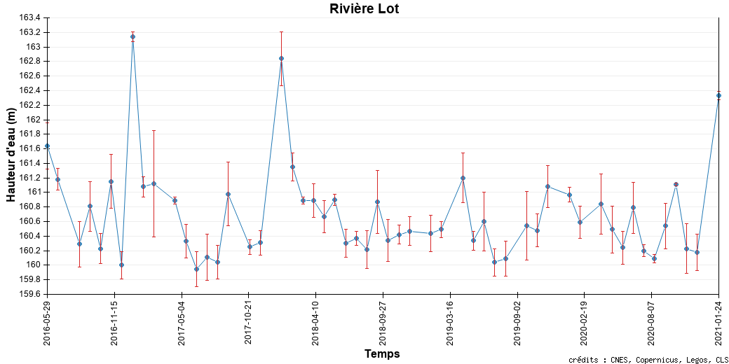
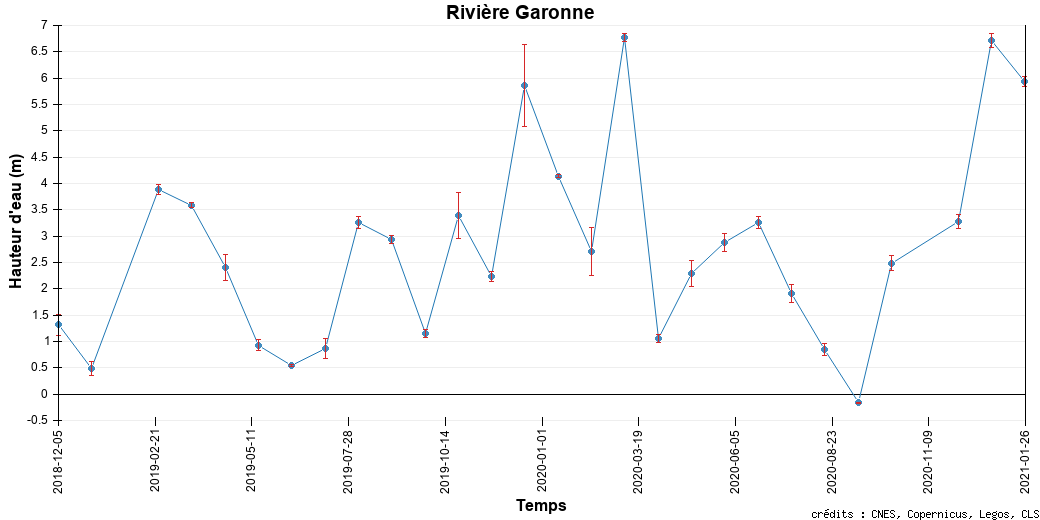
The Garonne river is one of the major rivers in France. Taking its source in the Pyrenees mountains bordering Spain, it goes North, through Toulouse, goes North-West, through Bordeaux, to reach the Atlantic Ocean in the Bay of Biscaye. This January 2021, intense precipitations over the South-West of France raised the level of the river and its tributaries, with a paroxysm at the end of January and early February with major flooding in the towns on the banks such as La Réole. Satellites shows this elevation, for altimeters, and even the flooding for imagery techniques (here Sentinel-1 SAR -- Swot might also provide such images once launched). |
 |
 |
 |
 |
 |
|
|
Map of La Réole flood from Sentinel-1 SAR data; in red, areas flooded between Jan. 27 and Feb. 2 (processing CLS, contains modified Copernicus data) |
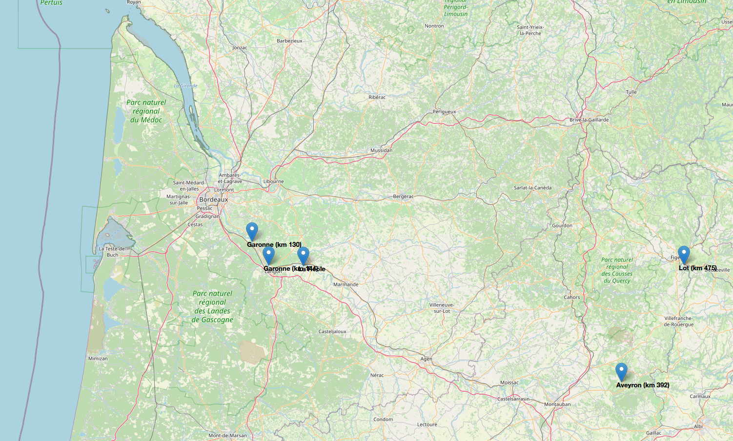
Altimetry water level variations, over the Aveyron tributary (km 392) (top left), Lot tributary (km 475) (bottom left), Garonne itself (top right, km 130; Bottom right km 144) (credit Hydroweb) |
|
