Tracking hurricanes
Image of the month - April 2001
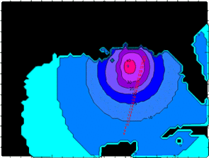
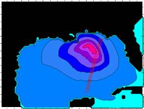
Wind speed (in m/s) and wave height (in m),65 h after Hurricane Opal passage, on October 4, 1995. (Credits Météo France).
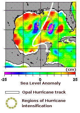
Hurricanes are among the most frequent catastrophic events in warm seas. Their birth is now well understood, but forecast of their path is of major importance for people living there.
Altimetry contribute to this forecast by collecting wave height and wind speed data, but also by the knowledge of ocean circulation it brings. Since heat of the underlying ocean plays a major role in hurricane birth and intensification, cold and warm eddies seen by Topex/Poseidon can modify path and intensity of hurricanes.
See also :
- Applications : Hurricanes.
Websites on this subject:
- Hurricanes
- Hurricanes online meteorology guide
- Altimetry and hurricanes
- Altimetry and hurricane intensification

