Rain
To be able to use altimetry measurements, we first have to correct them for the effects of atmospheric water - either rain or vapour. One of the side benefits of altimetry satellites is therefore acquiring information about these meteorological parameters, especially rain, for the entire ocean where there are very few meteorological stations. Such studies enable us to gain a better understanding of rain mechanisms and improve altimeter corrections, thus providing increasingly precise data.
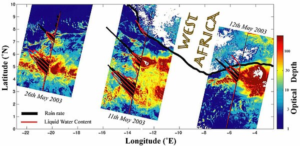
Each frequency of a dual-frequency altimeter responds differently to rain. This not only makes it possible to accurately detect rain events, but can also be used to yield quantitative values. However these techniques are limited in time and space sampling of nadir-pointing instruments.
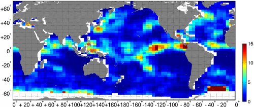
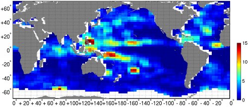
Monthly mean rain rate computed from Topex/Poseidon, for November 1997 (top, at the height of the 1997-1998 El Niño) and November 1999 (bottom, during La Niña). During El Niño rains are more abundant over the warm water pushed toward the South American coasts, whereas during La Niña most rains are over Indonesia and the 'Warm Pool'.
(Credits Ifremer / Cersat).
Further information :
- Image of the month :
- June 2005 : Cloudy skies.
- March 2000 : Raindrops keep falling on the sea.
- Ifremer : Effect of rain on altimeter backscatter.

