
The El Niño of the century?
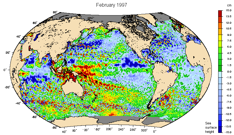
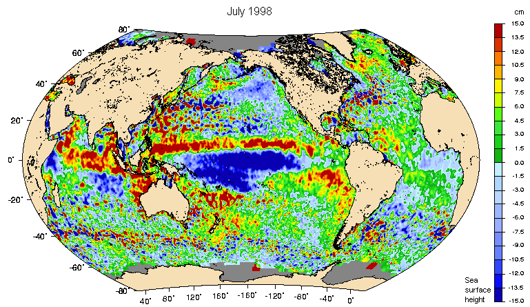
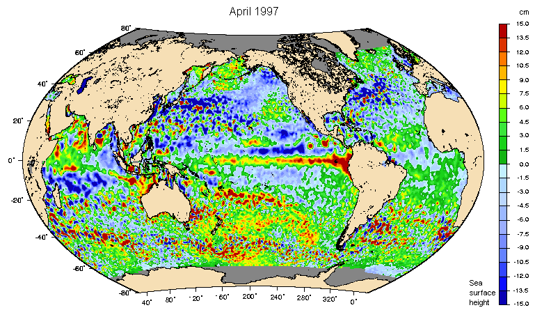
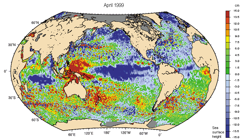
El Niño revealedFrom February to April 1997, Topex/Poseidon satellite data pinpointed a large eastward-moving swelling of waters in the central Pacific. This positive sea-level anomaly, over 10 cm and increasing as the months went by, peaked near the coast. In July 1997, the signature was plain and south-east Asia was hit by severe drought. The anomaly, in red on the map, covered an area 1.5 times that of the United States. It corresponded to "extra" warm waters. | Closely monitoring the tropical oceanTopex/Poseidon tracked the development of El Niño, highlighting a maximum anomaly of more than 20 cm in the northern winter. By June 1998, surface height was returning to normal. In July 1998, Topex/Poseidon revealed favourable conditions for La Niña, which developped in 1999. In 2000, ocean once more returned to normal. |


Sea level rises, temperature too
Surface temperatures near the Galápagos Islands increased clearly during the northern summer, reaching more than 5°C above normal. These anomalies signalled the start of slack trade winds and increased ocean and atmosphere interactions. The 28.5°C temperature threshold triggered atmospheric convection, producing heavy rains over coastal Ecuador and Peru.


