Hydrology from space at CTOH
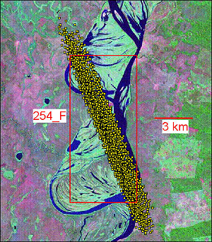
Our data base contains time series over water levels of large rivers, lakes and wetlands around the world. These time series are mainly based on altimetry data from Topex/Poseidon for rivers, but ERS-1 & 2, Envisat, Jason-1 and GFO data are also used for lakes. At present, water level time series of about 100 lakes (in Europe, Asia, Africa, North and South America) including Aral & Caspian seas are available. About 250 sites (called virtual stations) on large rivers are also available (see maps below). Users of the data base can visualize the water level time series as well as Landsat images showing the geographic location of the site. Users can download the numerical values of the time series as well as associated errors.

