Arctic sea ice extent as observed by Envisat
September 2007 saw a low sea ice extent record in Arctic with 4.10 million km² . September 2010 is the third low sea ice extent record with 4.60 million km² and 2011 shows a comparable low record than 2007. This has been seen by several sensors onboard satellites, the altimeter on Envisat among others. Indeed, for the first time in 2007, an altimetry satellite has measured open water sea surface height North East Siberia up to 82° during September.
The decrease of the sea ice extent is a problematic phenomena since the ice reflects the sun energy. Without ice, the sun radiations are absorbed by the ocean, thus increasing the warming.
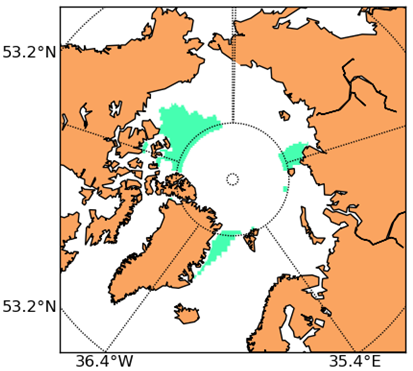

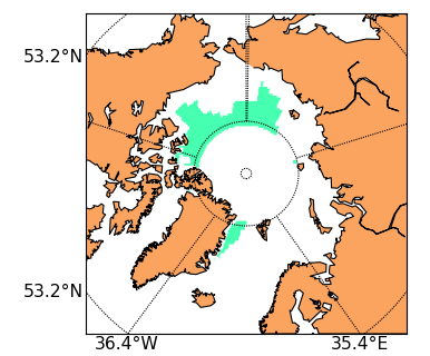
Monthly sea ice coverage averaged in 1°x1° boxes over September 2007 (left) September 2010 (middle) and September 2011 (right) derived from RA-2 data. White area is open water. (Credits CLS).
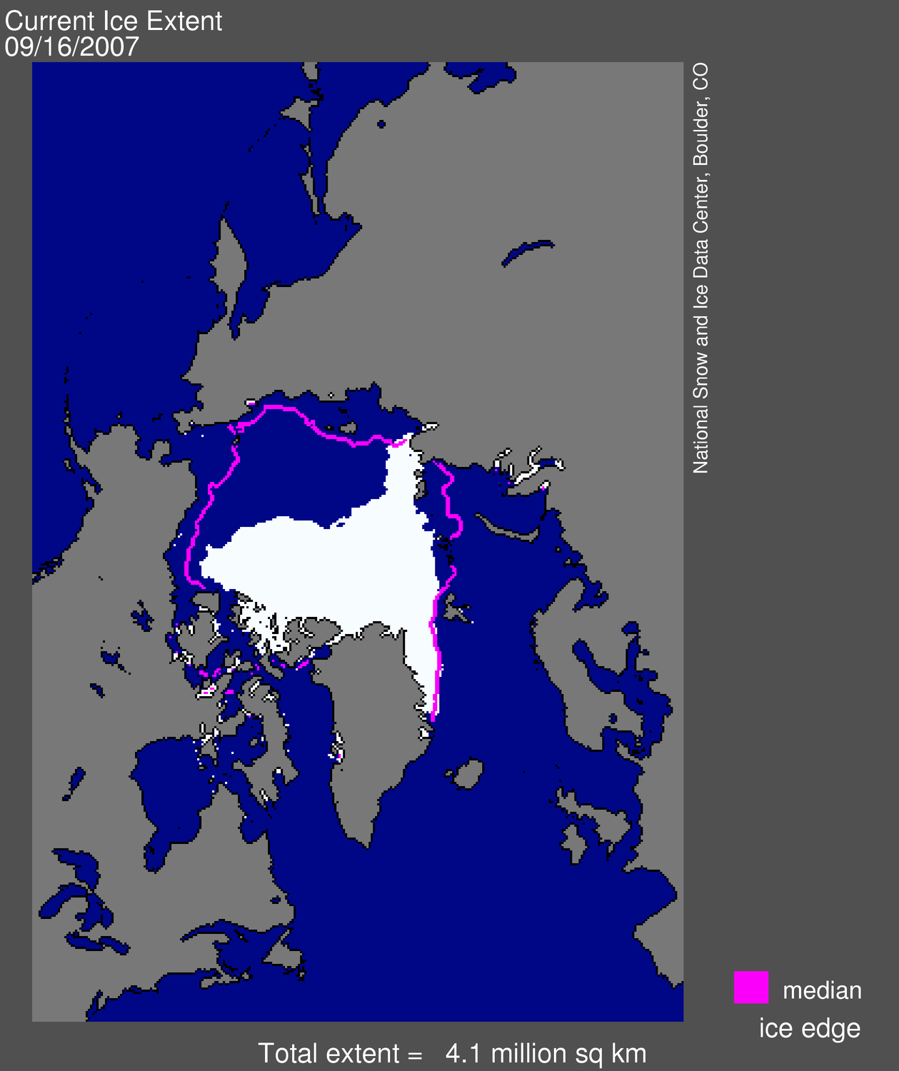
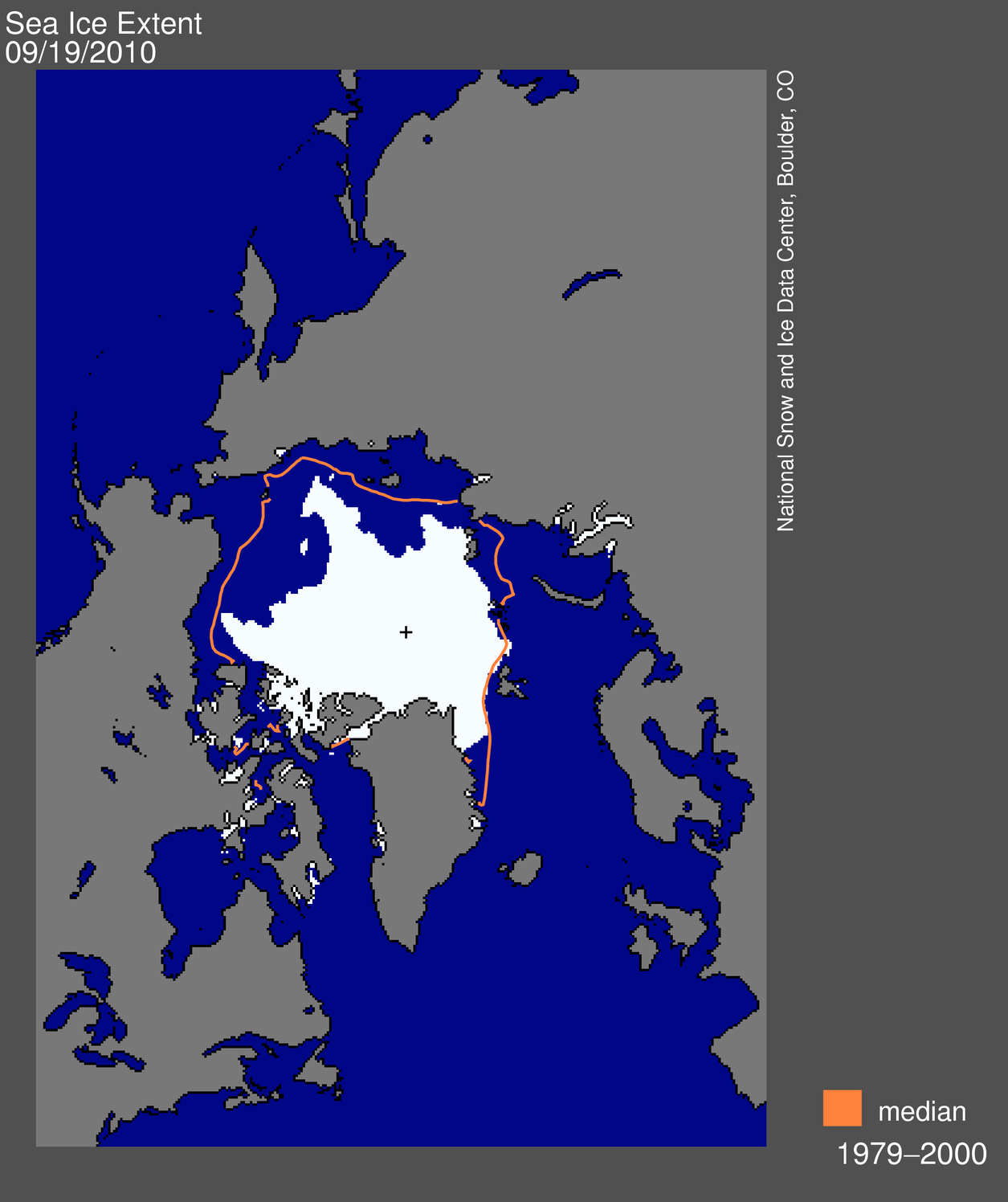
Daily Arctic sea ice extent derived from microwave measurements on September 16, 2007 (left) and September 19, 2010 (right). The pink and orange line show the 1979 to 2000 median extent for these days. Credits National Snow and Ice Data Center.

Further information:
- News (Sept. 2011): Arctic Sea ice extent near the low 2007 record
- Arctic sea ice new and analysis on the National Snow and Ice Data Center (NSIDC) website

