Altimetry and buoys
(Source: Météo France/CLS, 2002)
At first sight, using in-situ sensors like drifting buoys in combination with altimetry data might seem like overkill. However, both sources of data complement one another very well, each yielding unique information. For example, in-situ measurements validate altimetry data while sea surface heights measured by satellite altimetry help to deploy buoys more precisely.
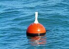
Drifting buoys-floats with a floating anchor suspended 15 meters below the surface-are used to track surface currents. They are also useful for meteorologists, since a barometer or wind-measuring device can be fitted to them. Wind data collected by buoys are used to calculate the current due to wind (Ekman current) and, at a larger scale, the current due to the Earth's rotation (geostrophic currents).
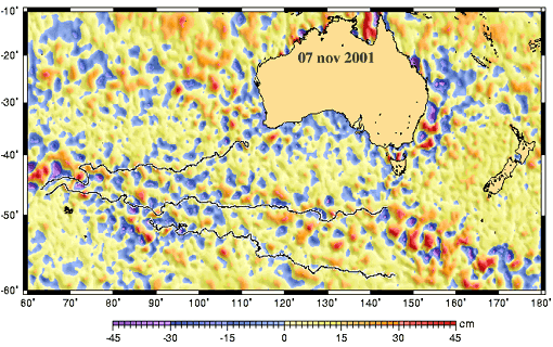
Sea level anomalies and trajectories of drifting buoys tracked by Argos in the North Atlantic, in a zone where there are no major currents. This diagram shows how the buoys tend to follow eddies. The effect of tides is also clearly visible in the small looping patterns (in particular on the plot farthest north) (see animation, 5.9 Mb).
(Credits Météo France/CLS)
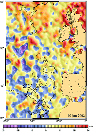
Sea level anomalies and trajectories of drifting buoys tracked by Argos (see animation, 3.7 Mb). The buoys mainly follow the Antarctic Circumpolar Current, despite circling in places due mostly to eddies. According to the data, these buoys must have all lost their floating anchor between May 13 and May 25, 2001. It is odd that they continued to follow the current and eddies.
(Credits Météo France/CLS).
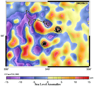
Sea level anomalies and trajectories of drifting buoys tracked by Argos in the North Atlantic, west of Ireland. These buoys have been "trapped" inside eddies, which are clearly visible as peaks and valleys in sea level anomaly maps (see animation, 1 Mb).
(Credits Météo France/CLS).
Sometimes, drifting buoys can be "trapped" in an eddy and circle it in one direction or the other, depending on whether the eddy forms a peak or valley in the ocean surface, and depending on the hemisphere (see A turbulent sea and Current relief). This trapping of drifting buoys collecting meteorological readings proves useful, since the buoys stay in the same place. The advantage of drifting buoys over moored buoys is that they are cheap to produce and deploy. One drawback, however, is that they are sometimes washed up on the shore. Eddies compensate for this natural tendency.
Until now, buoys became trapped in eddies by pure chance. In future, operational oceanography, especially near-real-time altimetry data (from Ssalto/Duacs) and ocean forecasts (Mercator), will make it possible to deploy buoys inside eddies detected by altimetry.

