Jason-1, Jason-2 and Envisat GDR 2012 validation
The validation activities performed on Jason-1, Jason-2 and Envisat GDR 2012 data are synthesized in 3 reports (see systematic validation web page). They assess the altimeter data quality: missing and edited measurements, relevant parameters derived from instrumental measurements and geophysical corrections. Analyses are also focused on cross-calibration to precisely assess parameter discrepancies between missions in order to detect geographically correlated biases, jumps or drifts.
For the first time this year, all the Geophysical Data Record (GDR) Jason-2 products were reprocessed on the whole time series. The comparison between the previous GDR data set (GDR-T) and the new one (GDR-D) are detailed in a dedicated document (see dedicated Jason-2 reprocessing web page).
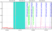
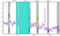
After two successive safe hold mode events in february and march 2012, Jason-1 was manoeuvered into a geodetic orbit in April and May 2012.
The Envisat mission ended on April 8, 2012. In spite of efforts to resume contact with the satellite, the end of the missions operations was declared by European Space Agency on the May 9, 2012. Then 10 years of data are available, with a very good quality and availability and provided to users. These data are also homogeneous and allows to improve the computation of Envisat MSL. This year V2.1 reprocessed dataset was enhanced on several aspects. Last year studies had evidenced some perfectible aspects (lien vers rapport retraitement et bilan annuel 2011) which are actually solved this year. The V2.1+ dataset was upgraded with four corrections:
- PTR with an impact on Global Mean Sea Level (see 2011 annual report and Ollivier et al., 2012);
- POE standard with an impact on Regional Mean Sea Level (see 2011 annual report and Ollivier et al., 2012);
- Radiometer wet tropospheric correction with an impact on performances at crossovers
- Sea State Bias with an impact on performances at crossovers and on mean of SLA
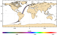
Jason-1 new geodetic orbit:
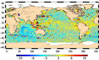
Performances at crossovers
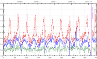
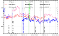
Wet troposphere correction for Jason-1 and Jason-2:
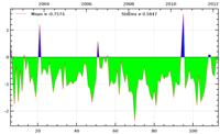
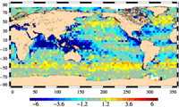
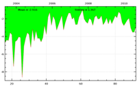
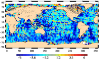
As the wet troposphere correction is a very important variable for mean sea level trend calculation, (radiometer - ECMWF model) wet troposphere correction differences are continously monitored for GDRs as well as for IGDRs.
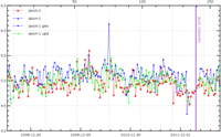
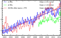
In terms of Mean Sea Level:
The Envisat V2.1+ evolution enables to improve data (see MSL page):
- the effect on global MSL is largely dominated by the PTR evolution (Ollivier et al., 2012) while
- the effect on regional MSL is largely dominated by the POE evolution (Ollivier et al., 2012).
This results in a good consistency between J1 and Envisat on the whole time series. However, multimission and in situ comparisons enabled to evidence some remaining issues, notably on the first year of the Envisat mission, still to be understood.
Further information:
- Ollivier A., Y.Faugere, N. Picot, M. Ablain, P. Femenias and J. Benveniste, 2012, Envisat ocean altimeter becoming relevant for Mean Sea Level Trend Studies, Marine Geodesy Vol 35
- Valladeau G, J.-F. Legeais, M. Ablain, S. Guinehut and N. Picot, 2012: "Comparing Altimetry with Tide Gauges and Argo profiling floats for data quality assessment and Mean Sea Level studies. Marine Geodesy, Vol. 35, Iss. sup1.
- Systematic Validation activties
- Jason-1 2012 Annual validation report
- Jason-2 2012 Annual validation report
- Envisat 2012 Annual validation report
- Jason-2 reprocessing report
- Mean Sea Level Rise
