Meeting the Mindanao and the Kuroshio currents
Lively data, November 23, 2009
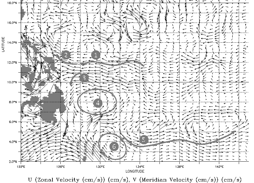
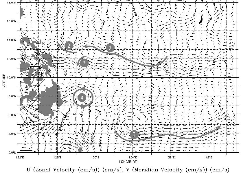
The western equatorial Pacific Ocean is an area with a complex circulation. This area plays an important role in the basin-scale circulation and in the development of El Niño events. Furthermore it's the place where waters flow westward, in the Indian Ocean, via the Indonesian seas.
The geostrophic velocities derived from SLA and plotted with vectors in the LAS can help to understand this circulation and its variations on a small area approaching the Philippines:
- the North Equatorial Current (NEC, noted "1" on the opposite maps) flows westward and splits as it encounters the Philippines, separating into a northwestward-flowing current (the Kuroshio, noted "2") and the south-flowing Mindanao Current (noted "3"). The bifurcation of the NEC into these two branches moves in latitudes on the seasonnal timescale (the northernmost position occurs in October and the southernmost position in February) and on the interannual timescale (the bifurcation latitude takes place at higher latitudes during the El Niño years,
- A quasi permanent Mindanao cyclonic eddy (noted "4") corresponding to a depression is centered around 130°E and 7.5°N. It is associated with the turning of NEC waters at the eastern coast of the Philippines, and their subsequent flow to the east in the North Equatorial Countercurrent (noted "5").
- An anticyclonic eddy is observed in June (map on top, (noted "6") northeast of Halmahera Island near 132°E and 3°N.
Further information:
- Applications, Ocean, Mesoscale circulation, Eddies around the world
- Applications, Ocean, Large-scale circulation, Boundary currents: the Gulf Stream and the Kuroshio.
 Use the Live Access Server

