Cold waters and wet African monsoon
Lively data: September 21, 2009
One of our previous Lively data focused on a drier African monsoon in 2006 and 2007 (December 14, 2007: An African monsoon drier than usual). MSLA averaged during June-September of these years clearly highlighted the warming of the ocean waters in the Gulf of Guinea.
Recent results of the Amma program has revealed evidence for the formation of cold water in the Gulf of Guinea as a key step in the onset of monsoon rains. By studying SLA in this area, it thus possible to improved the forecasting of the arrival of the rainy season.
The series of MSLA realized in 2007 is here extended for 2008 with Delayed-Time data and for 2009 with Near-Real-Time data. In contrast of 2008 or 2007, the MSLA averaged between June-August 2009 shows a tongue of negative sea level anomalies (cold waters) along the Equator. This contrast is even more strinking for the only month of August 2009, where at the same time, western Africa was hit by devastating floods.
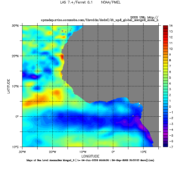
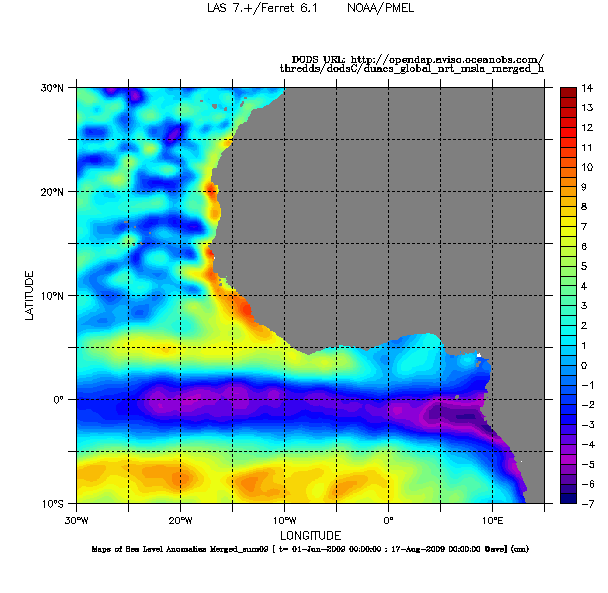
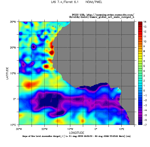
Maps of Sea Level Anomalies (SLA) in cm in the Gulf of Guinea, averaged from June to September for 2008 (on the left, made with DT data), and from June to August 2009 (on the middle, made from NRT data) and from the only month of August 2009 (on the right, made from NRT data). Choose DT (or NRT) - Global - (Maps of) Sea Level Anomalies then, in Define variable and Select analysis type, select Average and finally in Apply to these axes, click on "T". Choose also the period and the geographical area. Sature the color palette in Select options and Color fill levels (-7,14,0.5).
Further information:
- Lively data: An African monsoon drier than usual
- Research program Amma
- Amma website: Press conference, 2009/09/10
 Use the Live Access Server

